
A very cold airmass will settle in to the area tonight and Friday morning. This will lead to widespread sub-freezing temperatures across the northern and western parts of the area. Some spots may see a hard freeze which would mean temperatures under 28. The best chance for this will be up the Pearl River and I-59 corridors where we typically see colder numbers. These are the areas where you could cover any exposed faucets outside and leave water dripping from one faucet.
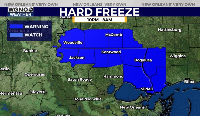
Everyone across the northern and western areas should cover any sensitive crops or outdoor vegetation. Areas not in the hard freeze warning area under a freeze warning which means temperatures of 28-32.

Chilly conditions will continue over the next few days. Friday will be nicer with more sun but still only see highs in the mid to upper 50s. Another system comes in to start the weekend with a chance for some showers on Saturday and temperatures that will struggle to get out of the 40s.


