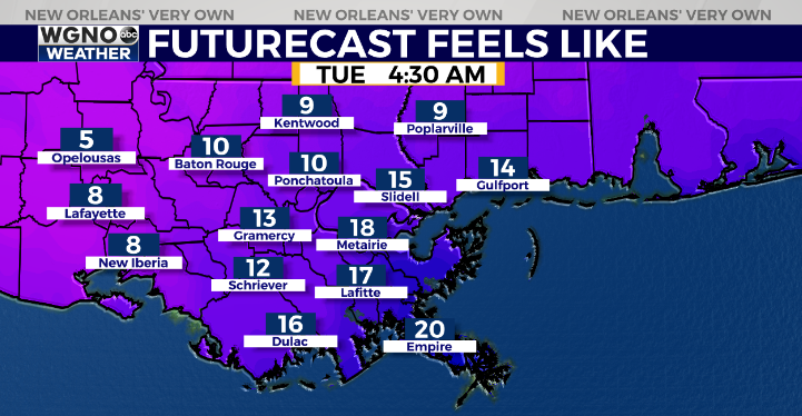
A hard freeze is likely for the entire area tonight and Tuesday morning as the coldest air in several years moves in.
Look for temperatures to drop into the mid and upper teens in the northern half of the area. These temperatures will last for several hours making conditions hazardous for exposed pipes and faucets.

On the south shore temperatures will drop into the low to mid 20s. These temperatures will also be cold enough to cause damage to exposed pipes. Insulate pipes and outdoor faucets and leave a small stream of water flowing from one faucet overnight.

The other issue will be the wind. Forecast wind chill values reach the single digits early Tuesday in the colder spots. This could be dangerous to be out in for any length of time. It’s best to just stay inside through midday Tuesday.
Highs Tuesday afternoon only reach into the upper 30s to around 40. After that we see another chance of rain Wednesday evening through Thursday morning with another cold of cold air behind it. However it will not be as cold as the current arctic air.
Check out current conditions near you: https://digital-stage.wgno.com/weather/new-orleans-weather-radar/
Stay up to date with the latest forecast: digital-stage.wgno.com/weather/forecast/
Download the WGNO Weather App to stay connected this hurricane season


