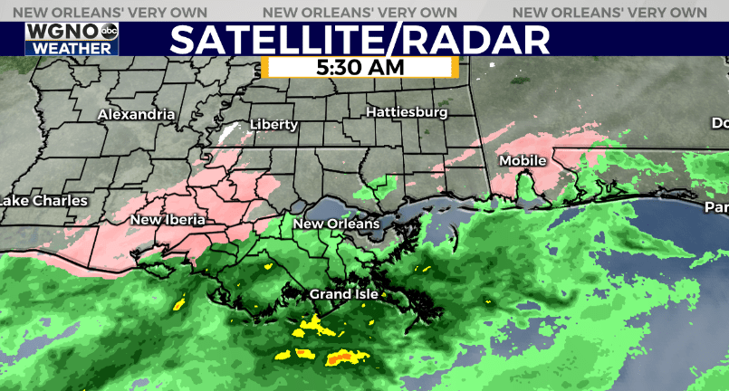
We are going to continue watching the radar through the morning with the slight chance of seeing sleet and freezing rain in our area. Right now the moisture is falling as rain across our area with warmer temperatures south of I-10. However there is a larger area of the pink on the radar moving through Baton Rouge. Temperatures stay around freezing as far east as I-55. If that moisture holds together these would be the spots with the best chance of seeing some ice form on bridges or overpasses. Most of the area should avoid issues.
The main story the next couple of days will be the cold temperatures. Temperatures only warm into the low 40s this afternoon with cloudy skies. After that very cold air moves in tonight.
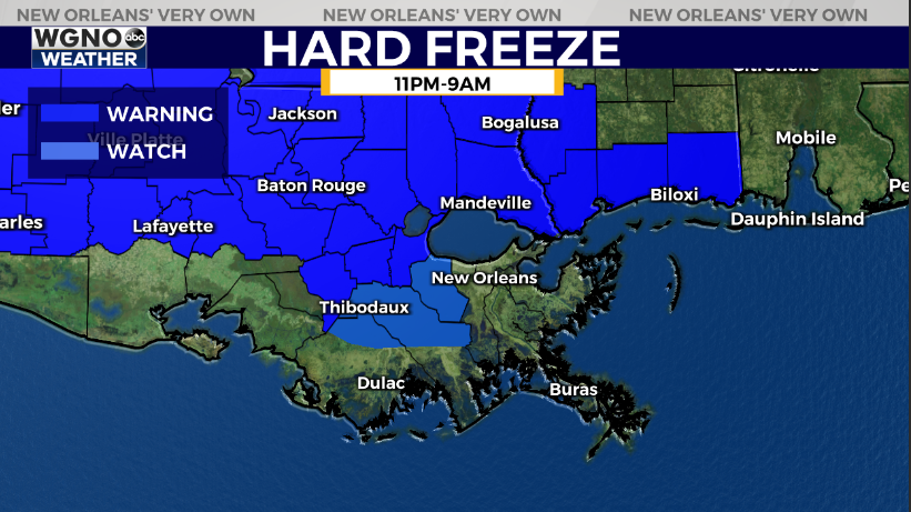
We have a hard freeze warning in effect for many areas north of I-10 including southern Mississippi. These are the spots you need to wrap up the pipes and outdoor faucets along with the plants and pets. Temperatures will be dropping into the mid 20s by Saturday morning and again on Sunday morning.
South shore areas are under a freeze warning and it would be a good idea to protect the plants.
After a cold day today we see sun through the weekend but highs will only be in the low to mid 50s.