Hurricane #Delta has weakened overnight with landfall near Cancun, Mexico as a Category 2 with 110mph winds. Slight weakening expected over the next 6-12 hours as system crosses the Yucatan & enters the southern Gulf.
Hurricane Watches are likely to be issued for a large section of the Louisiana coast later this morning, 48 hour in advance of the onset of tropical storm force winds.

By this afternoon, Delta will emerge over the southern Gulf of Mexico. Conditions appear favorable for re-intensification to a Category 4 hurricane over the next 36 hours. Wind field is likely to expand & grow in size.
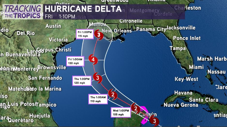
Overnight, the models have not shifted much with growing concern for impacts in Acadiana/south-central Louisiana. Projected landfall in south Louisiana on Friday early afternoon between Abbeville and Morgan City. Cone of uncertainty stretches from Slidell, LA to Beaumont, TX.
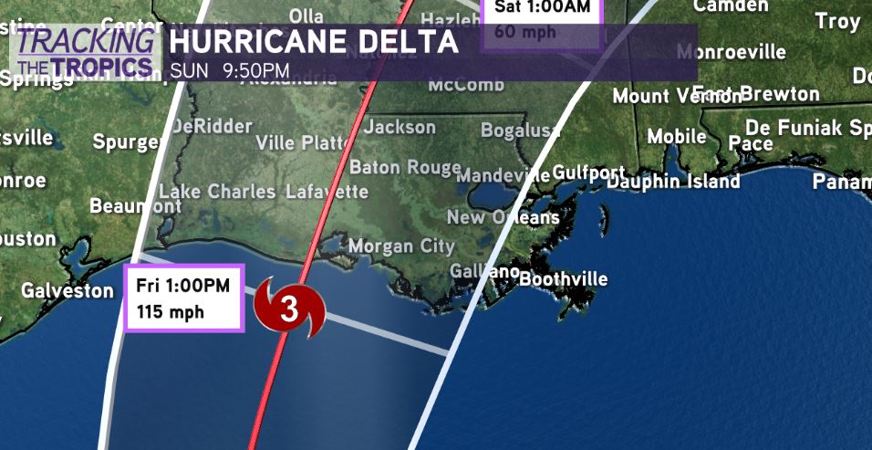
System appears likely to experience slightly less favorable conditions as it approaches south Louisiana, potentially weakening the system before landfall. To what extent does it weaken? That remains to be seen. Most projections bring Delta as a strong category 2 or 3 intensity system towards Louisiana.
CAN THE TRACK SHIFT? Yes! We’re still 2 1/2 days out from a potential landfall. Average error of track is 80-100 miles 2 1/2 days in advance of projected landfall. However, confidence continues to grow in life-threatening storm surge and hurricane force winds along Louisiana’s coast beginning Friday.
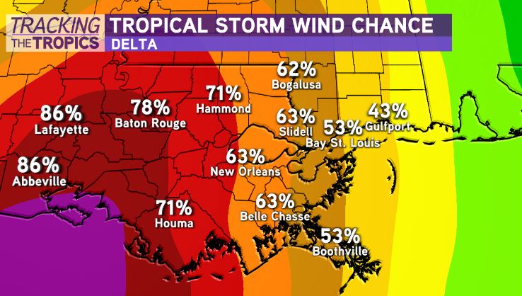
Yet again, we are faced with a scenario where 50-100 miles will make all the difference for Metro New Orleans. 100 miles further west, our impacts will drop. Further east, our impacts go up. It’s too early to let your guard down. Stay vigilant.
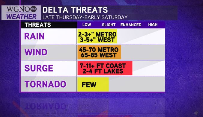
Prepare for at least 45-70mph wind gusts in the New Orleans Metro & 2-4″ of rainfall. Power outages likely, especially in the Bayou Parishes & River Parishes.
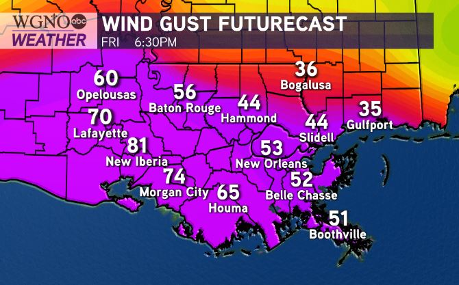
I would prepare for at least 90-120+ mph gusts along the coast near landfall location, substantial storm surge of 7-11+ feet potential from Intracoastal City to the Mouth of the Mississippi River, & heavy rain risk East of the center. Official storm surge numbers will be released from the Hurricane Center later today.
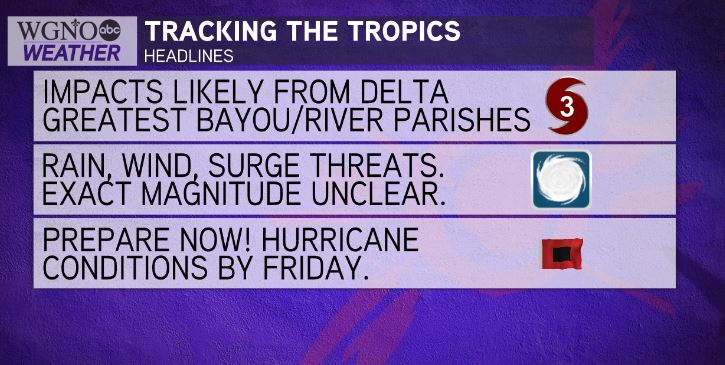
Unfortunately, with a system like this, you don’t have the luxury of betting on the system weakening. You must prepare as if system won’t weaken. Time to ready the storm preparations & be prepared to act!
Hurricane Watches likely to be issued later today for a large section of the Louisiana coast, 48 hours in advance of the onset of tropical storm force winds.
Stay tuned.
Check out current conditions near you: digital-stage.wgno.com/weather/maps-and-radar/
Stay up to date with the latest forecast: digital-stage.wgno.com/weather/forecast/
Download the WGNO Weather App to stay connected this hurricane season


