JUST IN — Hurricane #Delta is now a Category 2 with max winds of 100mph. Re-strengthening to a Category 3 is likely over the next 18-24 hours with low wind shear & warm water temperatures.
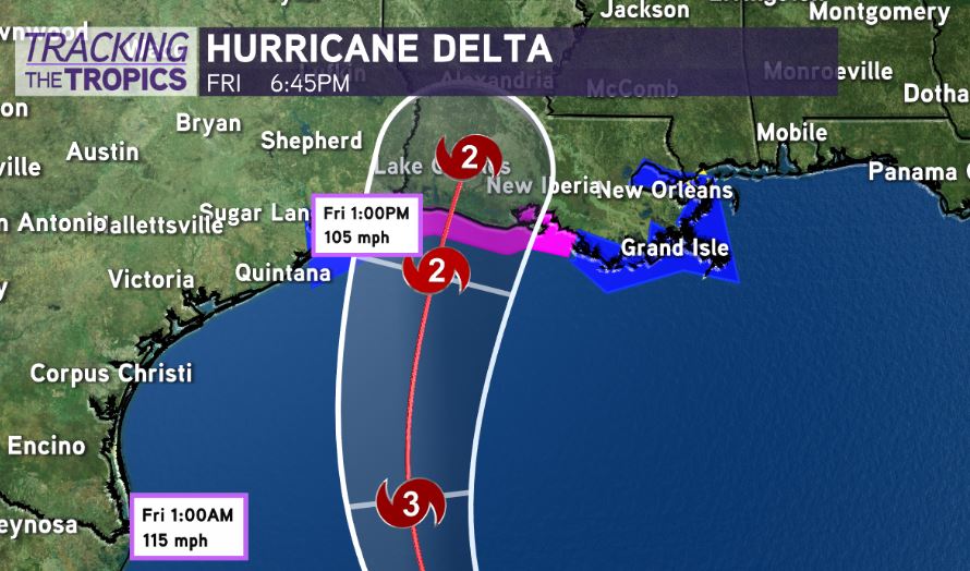
The latest forecast track is nearly unchanged. Landfall now projected in Eastern Cameron/Vermilion Parish near Lake Arthur/Gueydan/Kaplan as a Category 2 hurricane mid day Friday-Friday afternoon with 105mph winds. Could the system be weaker? Yes, that’s possible given cooler water temperatures in the Gulf of Mexico shelf.
But, you don’t have the luxury betting on it weakening, and you must be prepared that it won’t. Don’t let the system fool you, even if it is slightly weaker, even for us here in southeast Louisiana. Hurricane Delta continues to grow much larger in size, which increases the radius of impacts across Louisiana.
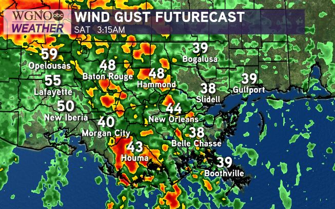
Greatest hurricane impacts to Acadiana/south-central Louisiana. However, tropical storm force gusts would still be likely on the projected path all the way to Metro New Orleans. Sporadic power outages. We’re feeling much better in terms of lower impacts for the New Orleans Metro, but I am still expecting tropical storm impacts.
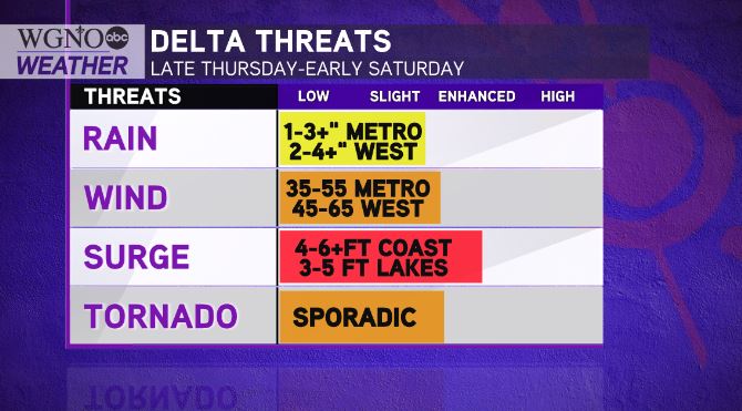
Life-threatening storm surge and hurricane force winds for Acadiana & south Louisiana’s coast beginning Friday. Sporadic rain bands & isolated tornado risk even on Thursday-Thursday night.
Remember, simply because the system’s center may not impact you…doesn’t mean you won’t see impacts well east of where the center comes onshore. Storm Surge Warning has been issued for the northern Gulf coast from Sabine Pass to Ocean Springs, Mississippi including Calcasieu Lake, Vermilion Bay, Lake Pontchartrain, Lake Maurepas, and Lake Borgne.
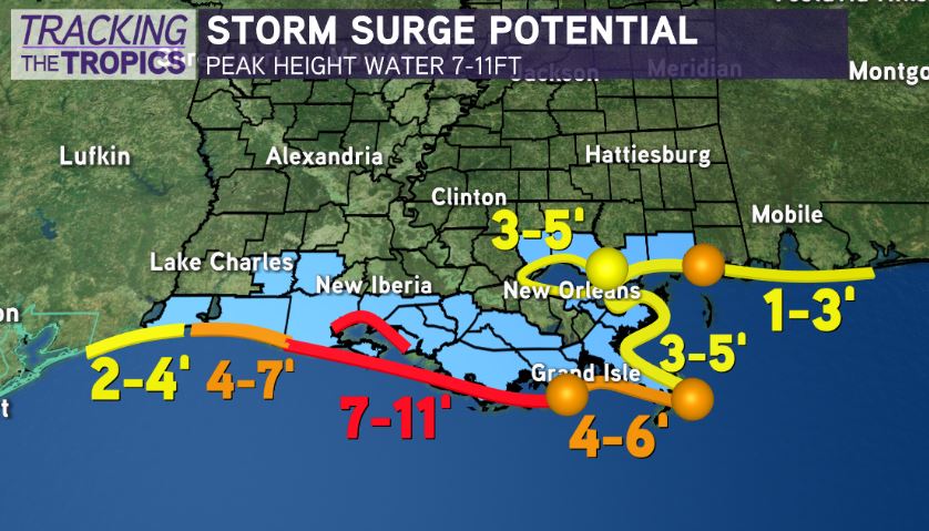
Significant coastal flooding from Pecan Island/Intracoastal City to coastal Terrebonne Parish. 7-11feet of storm surge expected from Pecan Island to Port Fourchon. This includes Vermilion Bay. This amount of inundation is life-threatening.
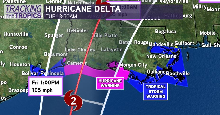
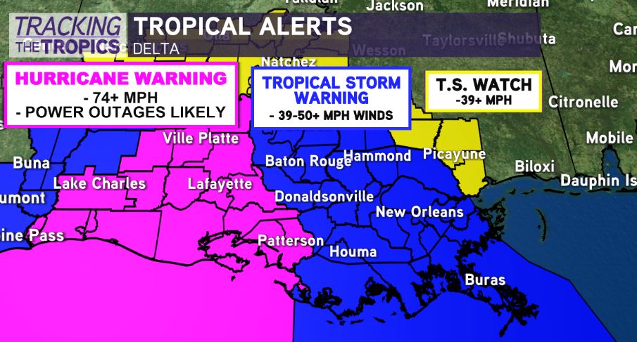
If you’re in a low-lying location and an evacuation order is called, LEAVE! 4-6 feet from Grand Isle to the Mouth of the Mississippi River. 3-5 feet in Lake Borgne/Pontchartrain. Hurricane Warning has been issued for the northern Gulf coast from Sabine Pass to Morgan City, Louisiana.
A Tropical Storm Warning from east of Morgan City to the Mouth of the Pearl River. This includes the city of New Orleans, Lake Pontchartrain and Lake Maurepas.
Overall, in southeast Louisiana, this won’t be a big deal for the most part. Biggest risk to the New Orleans Metro looks to arrive late Friday-Friday night.
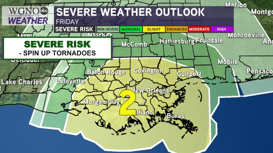
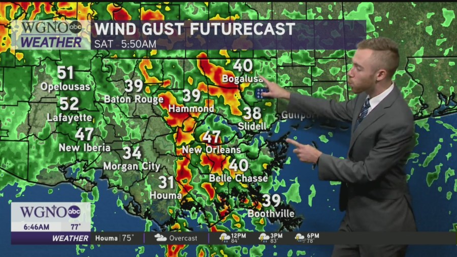
Slight Risk(Level 2 out of 5) for spin-up tornadoes. Wind gusts 35-55mph likely with rain bands. Rainfall 1-3″ expected, but we will have to monitor for localized higher amounts.