—
10:30 PM
Rain is still lingering across the Florida parishes but will be ending over the next couple of hours. A cold front will be pushing through Saturday morning bringing some really nice weather through the weekend with lower humidity.
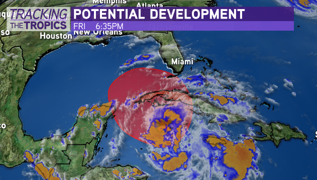
We will still be watching the tropical wave near Cuba over the next few days but right now the most likely scenario is this will stay east of our area into Florida. Still looking at another fall airmass by the end of next week.
—
6:30 PM
Rain will be tapering off through the evening ahead of a cold front moving in from the western part of the state. That front may bring a couple showers overnight but most of the rain with it will fade out.
Expect drier weather over the next few days with lower humidity. It now looks like the front will be a little stronger so it should be a very pleasant weekend especially Saturday night and early Sunday.
Look for humidity to come back next week along with rain chances as part or all of a tropical system move north.

Right now that system in the Caribbean has a high chance of development from the National Hurricane Center. This is going to be something that could turn into another named storm. A strong system would most likely head to Florida, and frankly that is the most likely scenario in general.
However there is a chance that at least some of this moves into the northern Gulf for the middle of next week. It does not look like it would be a big issue, most likely just rain, but still something to monitor through the weekend.


