
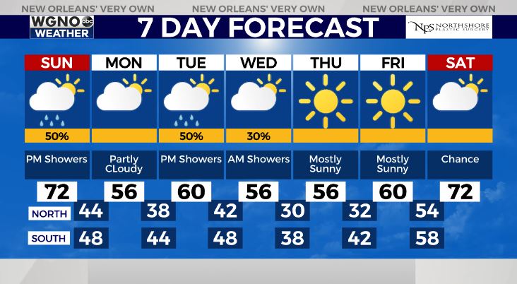
New Orleans’ forecast for Sunday morning includes limited shower activity near coastal areas.
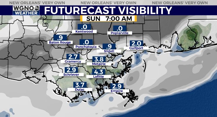
Patchy fog may be becoming an issue once more during the early hours, primarily north of I-10. Remember, at that point, low beams are your friend! Exercise caution on the roads if up early!
Highs by everyone’s afternoon after lunch should reach around 70 degrees! Rain in your neighborhood will return by evening as yet another system approaches Louisiana. At that point, reinforcing cool air moves through once more.
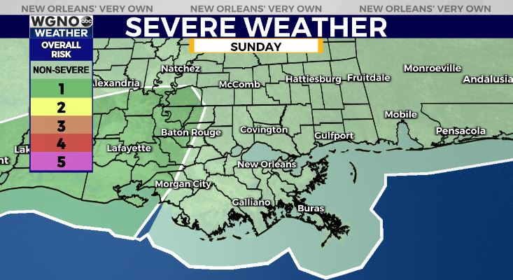
On radar, expect our storm threat at or WGNO’s 5PM newscast. Right now, no severe elements are area-wide concerns locally, though cities west could see a marginal risk of severe thunderstorms.
Conditions improve once this system moves east, then the colder air takes over behind this reinforcing trough.
Anticipate a chilly start come late week given 30-40 degree temperature outlooks beyond Lake Pontchartrain. Remember all 3 Ps: people, pets, plants: fortunately, for these next few days, pipes won’t face any problems!
Check out current conditions near you: https://digital-stage.wgno.com/weather/new-orleans-weather-radar/
Stay up to date with the latest forecast: digital-stage.wgno.com/weather/forecast/
Download the WGNO Weather App to stay connected this hurricane season


