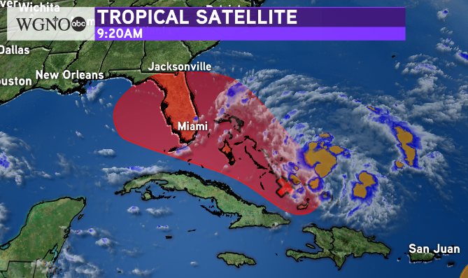
A broad area of low pressure southeast of the Bahamas now has a high chance of development in the next 5 days according to the National Hurricane Center. They put the chance at 80% and say that products like a storm track could be issued as early as later Thursday as a ‘Potential Tropical Cyclone’.
It is important to remember the area shaded in red is not a forecast track. This is the area that a system such as a depression or storm could form if it does so. After that forecast tracks and intensities will be issued.
Right now the system still look relatively ragged, although surface observations indicate winds are increasing and pressures are falling.
There is still a large range of future tracks from the forecast models. This has to deal a lot with the fact that there is no center. Once that is established models should have a better idea of where this is going.
Currently the impacts to the north central Gulf look minimal. If that system does come this way it would most likely be fairly weak. The highest chance at the moment is that this stays east over Florida or up the east coast.
However the potential is still there for a storm in the Gulf of Mexico. Stay updated on the latest forecast over the weekend.
As always stay with WGNO on air and online for the latest.