A lot of discussions are going around about a tropical wave to the east of Puerto Rico. First, it is important to realize this is only a wave. We do not yet have a classified system like a depression or storm.
What we do have is a broad area of low pressure that is currently drifting west-northwest through the western Atlantic. Strengthening of this system could occur in the next 48 hours but is more likely to happen after that point.
Forecast models are ranging in both the location of a potential storm and also the intensity. It is important to note that this still has several days to develop, and it is still way too early to know what will happen.
However, it is looking more likely that we will see a tropical system of some sort in the Gulf of Mexico by early next week.

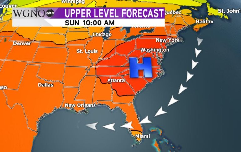
The above image is the upper-level forecast for Sunday morning. Most models agree on a strong area of high pressure setting up along the mid-Atlantic region. Because of that, it seems unlikely the wave would be able to move up the east coast.
The differences come in on the intensity of the system. A stronger storm would respond more to the steering currents and get pushed farther west, while a weaker storm may have more of a northerly movement. So again, too early to tell exactly what the scenario at play will be.
The important thing to focus on now is preparation. This is still several days away. Have a plan in place should you need to evacuate or stay at home for several days without power. Keep in mind areas like Baton Rouge are dealing with flood clean-up and may not be a suitable evacuation location.
Continue to stay with us at WGNO as we watch the potential development of this system, and develop your plan accordingly.


