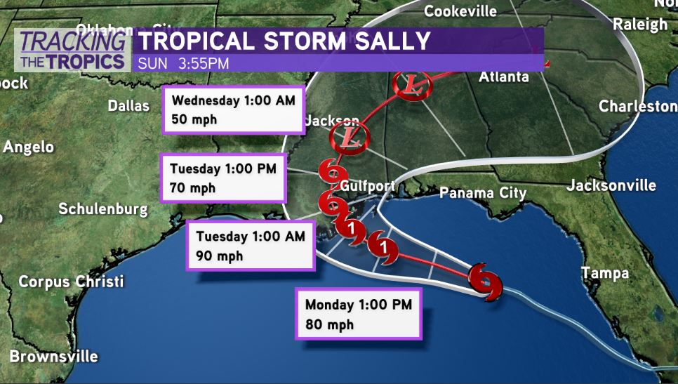
Tropical Storm Sally is still struggling to organize in a quick fashion this evening. Max winds are still 60 miles per hour. Northwesterly wind shear continues to hinder the system, making it lopsided in appearance with most of the thunderstorm action south and east of its center.
Forecast models showcase shear becoming less impactful later today or tonight, but this has yet to occur. The longer this shear impacts the system, the smaller the window will be for any stunt of more rapid intensification.
The National Hurricane Center’s official forecast brings the system to a Category 1 with 90 mile per hour winds before landfall in southeast Louisiana.
The latest track shifted a little farther east. Hurricane Warnings have been expanded to include the Bayou Parishes. Prepare for a significant weather event to unfold across southeast Louisiana, south Mississippi, south Alabama over the next 72 to 96 hours.
The system still battling some northwest wind shear, which is keeping intensification steady rather than rapid.
Landfall is expected Monday night to Tuesday as a strong Category 1 with max winds of 90 mph.
Category 1 or 2, this will be moving SLOW, which will exacerbate the storm surge, heavy rainfall, and wind impacts.
The National Hurricane Center mentions, “Sally could be slightly stronger at landfall than indicated below since it is forecast to reach the coast between the 36 hour forecast point and 48 hour when it is inland over southeast Louisiana.”
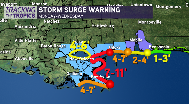
The key to Sally’s strength will be it’s ability to organize later today as shear decreases. Low-lying residents outside of levee protection, evacuate and leave. Do not stay. 7-11 feet of storm surge projected from the mouth of the Mississippi to Ocean Springs, Mississippi.
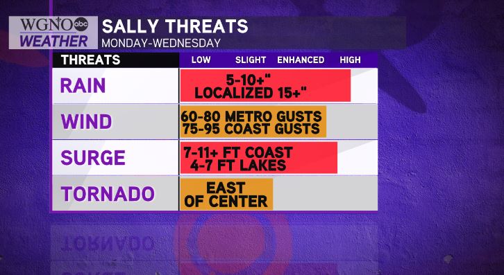
If you’re in Metro New Orleans, prepare for a potential hurricane strike. On it’s current track, this system will pose a significant rainfall threat with power outages likely.
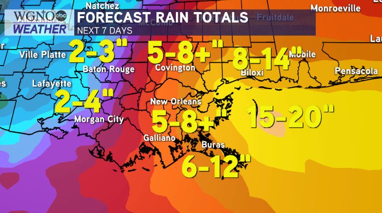
Flash flooding will be the bigger concern. Wind gusts of 65-90 miles per hour are possible on the system’s current track, along with 8-12+ inches of rainfall. Localized 15-20″ amounts will be possible.
Preparations need to be rushed to completion, as impacts will begin early Monday.
Landfall will be very slow to occur, which will exacerbate the flash flooding, wind, and storm surge impacts Monday through Wednesday. Expect to lose power.


