
Tropical Storm Claudette finally formed a closed circulation early Saturday morning after moving inland in southeast Louisiana to become the third named storm of the year. The main impacts of the storm though continue to push east across southern Mississippi and Alabama.
Many areas reported tropical storm force wind gusts overnight in the 30s and 40s in Louisiana with several locations along the Mississippi coast reporting gusts into the 50s.
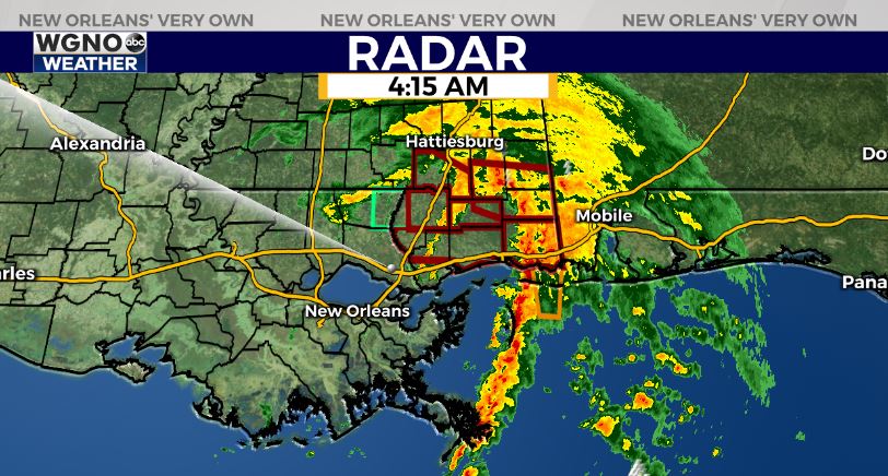
Locally heavy rain has been the main issue as expected with significant flooding from Slidell through southern Mississippi. Flash flood warnings remain in effect but the good news is the heaviest activity is now east of these areas.
Claudette will continue to quickly move northeast through the day Saturday ending the tropical weather threat for our area.
More rain will develop with scattered storms on Sunday which could also lead to localized street flooding with heavy downpours.