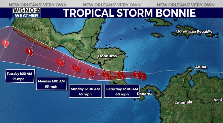
In the tropics, we are no longer watching several areas for possible development. In the northern Gulf of Mexico, the area of low pressure we’ve been tracking has a 0% chance of formation. This system will not develop, but it continues dumping rain in western Louisiana.
In the Atlantic, Potential Tropical Cyclone #2 has strengthened into Tropical Storm Bonnie with 40 mile per hour winds. It is moving west toward the southern Caribbean Sea, where environmental conditions are favorable for gradual strengthening.

It is expected to strengthen into a low-end hurricane before making landfall in Nicaragua this weekend. Likely to bring heavy rainfall & gusty winds to Nicaragua and Costa Rica. Localized 8-10+” of rainfall expected.
Behind Bonnie, NHC is also watching a tropical wave that is producing disorganized showers and thunderstorms. Conditions are not expected to become a little more conducive for development over the next couple of days as the system moves west-northwest toward the Leeward Islands. The next name on the list is Colin, but we continue welcoming July’s arrival with no tropical threats or concerns locally.


