Anticipate a quiet night tonight while clouds begin dissipating before we start our week on one much sunnier note. No rain chances look threatening Monday afternoon on radar, but highs will rise. Overall, the forecast for New Orleans, locally, remains mild overnight tomorrow to mid-week. One weak trough and front will push through by Tuesday, bringing humidity and temperatures down minimally.
This is your reminder Hurricane Season 2020 will not end until November 30th! Even throughout early November, Eta will be beginning to make landfall near the Florida Keys within 24 hours as a strong Tropical Storm or hurricane.

Plus, we continue watching yet another couple disturbances for formation potential.
These could be becoming named eventually, but right now, no local threats across our area are expected.
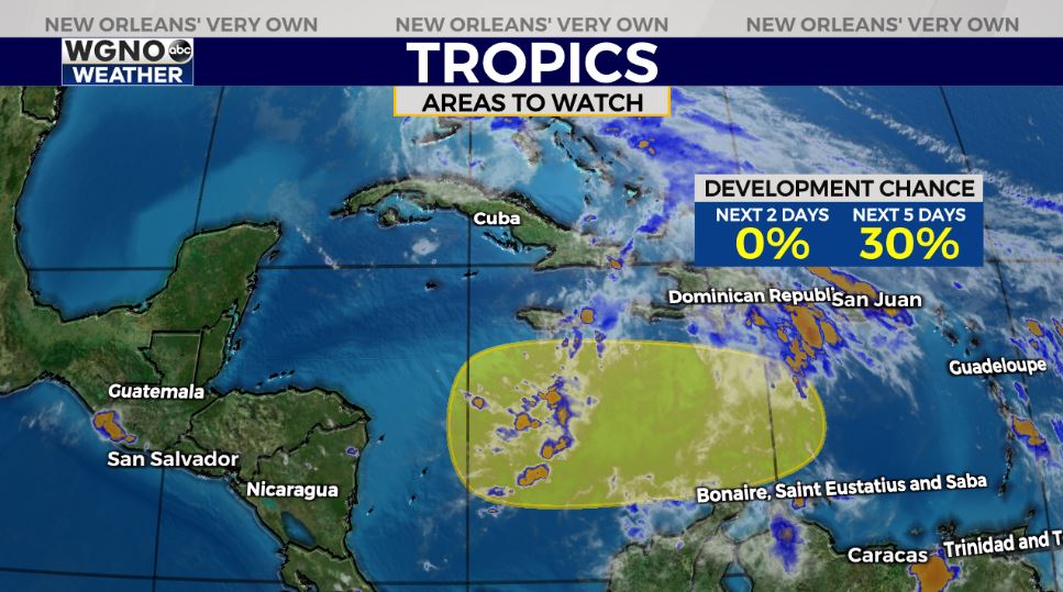
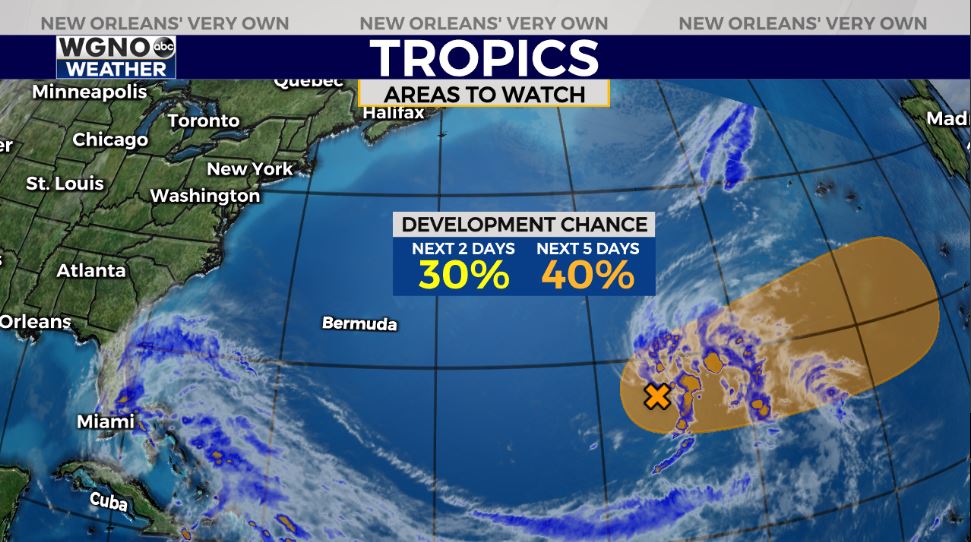
National Hurricane Center meteorologists give them the low to moderate 30-40 percent chances of development over five days.
Caribbean environments do support intensification on tap. Until Theta actually forms, if ever, track plus classification will stay tough to pinpoint.
Good news? Water temperatures have cooled significantly between Hurricanes Zeta and Eta’s upwelling as well as a few cold fronts impacting New Orleans.
Water temperatures, nonetheless, support tropical development, but such cooler water should hinder rapid intensification in very little time, possibly weakening any system that does organize.
Keep up, updates will be accessible online on WGNO.com and through our WGNO Weather App!
Check out current conditions near you: https://digital-stage.wgno.com/weather/new-orleans-weather-radar/
Stay up to date with the latest forecast: digital-stage.wgno.com/weather/forecast/
Download the WGNO Weather App to stay connected this hurricane season


