Hurricane Zeta is quickly intensifying in the Gulf of Mexico with maximum sustained winds at 110 miles per hour moving NNE at 24 miles per hour. This is officially a Category 2 storm, 1 mile per hour shy of a Category 3 hurricane.
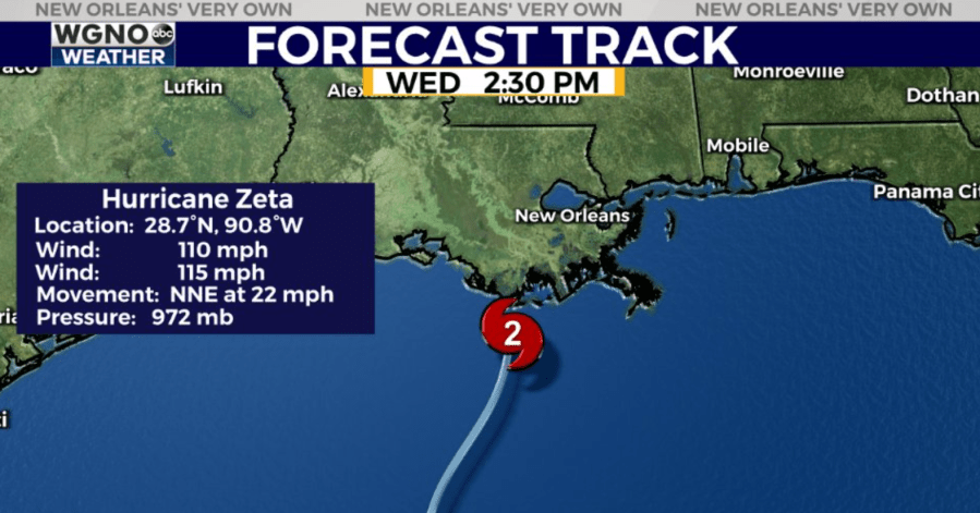
Zeta is forecast to make landfall as a Category 2 storm this afternoon with max winds of 105-110+ miles per hour. The Hurricane Hunters continue to find its pressure lowering, and this is a sign the system continues to strengthen.
Do not venture outside until this is over. This is a hunker down & “shelter in place” type of deal for southeast Louisiana & south Mississippi. Be prepared for widespread power outages and down trees in Hurricane Warning areas.
For southeast Louisiana and south Mississippi, this is not a drill. Rush last minute preparations to completion. Don’t take this storm lightly. Make sure you have all of your preparations finished ASAP, as conditions will quickly deteriorate this afternoon through evening.

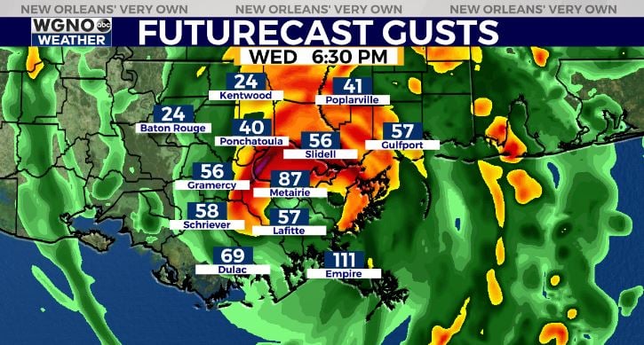
Be prepared for widespread power outages and trees down in Hurricane Warning areas. This is likely to be the most significant wind event for the area since Isaac in 2012, when NOLA clocked 80-85 mile per hour wind gusts. Unlike Isaac though, Zeta will be moving quickly, and most substantial wind impacts will only last 3-6 hours total.
Winds will quickly ramp up from 3PM-7PM across the area, with the system out of our area by 11PM. Be aware, even after the storm is passed, power lines and trees could be knocked down. Staying home until the sun rises Thursday morning will be best. Good news is a cold front will be behind Zeta to bring us a gorgeous forecast for the Halloween weekend ahead!
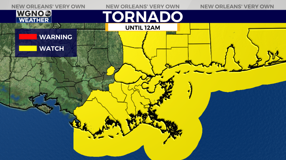
A Tornado Watch is issued for all areas shaded yellow until 12AM based off of tropical spin ups bringing a severe weather threat as Hurricane Zeta’s bands push inland in our area. Have ways to receive warning information on hand if these are issued, especially while power could be beginning to go off.
We’ll have more information on WGNO.com and WGNO all day today, so join in to see our brand new set and receive the latest developments.
Check out current conditions near you: https://digital-stage.wgno.com/weather/new-orleans-weather-radar/
Stay up to date with the latest forecast: digital-stage.wgno.com/weather/forecast/
Download the WGNO Weather App to stay connected this hurricane season


