
Tropical Storm Sally form Saturday afternoon near the southwest coast of Florida. The forecast track continues to take this storm northwest towards the central Gulf coast.
Everybody along the coast from central Louisiana to the western Florida panhandle needs to pay close attention to this. There will be the threat for significant life-threatening storm surge, damaging wind, and rainfall flooding.
The heaviest area of rain will likely be east of the center. As the storm slows near the coast this could create very heavy rainfall amounts.
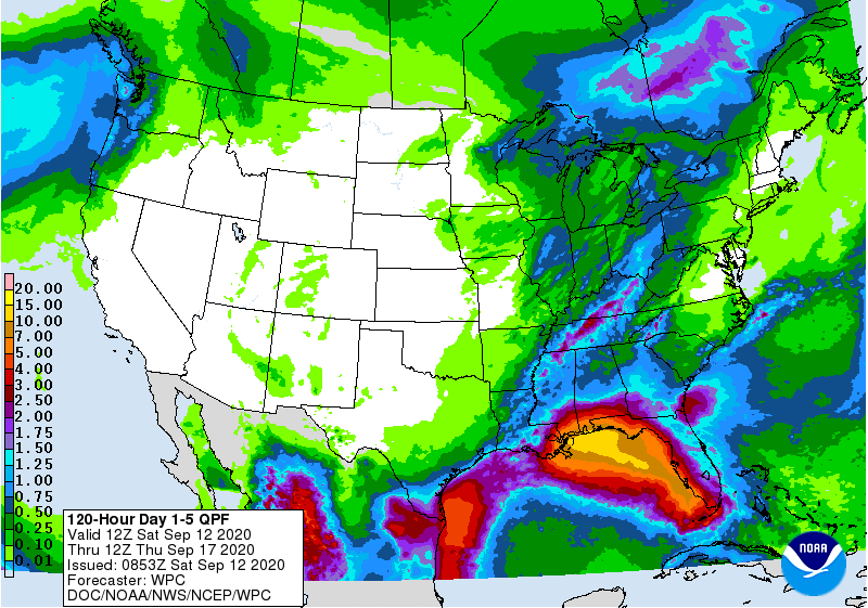
Current forecast predictions are in the range of 15 inches or more. This is just east of southeast Louisiana at the moment but obviously things are subject to change over the next few days.
Strongest impacts right now look to be along the Mississippi coast. This includes the possibility of significant storm surge.
Prepare now for a category two storm potential to your area if you are in the New Orleans area and east.
It is still a little early to sound the full alarm but you need to be prepared.
Stay with WGNO for the latest.
Check out current conditions near you: https://digital-stage.wgno.com/weather/new-orleans-weather-radar/
Stay up to date with the latest forecast: digital-stage.wgno.com/weather/forecast/
Download the WGNO Weather App to stay connected this hurricane season