
NEW ORLEANS (WGNO) — Forecasters at the National Hurricane Center are keeping a close eye on a system in the southwestern Gulf of Mexico.
Satellite imagery indicates a tropical wave located over the Bay of Campeche has become better organized as of Friday morning. It is expected to gradually strengthen as it moves toward the western Gulf of Mexico.
The NHC says the disturbance now has a 60 percent chance of formation over the next 48 hours. However, conditions are ripe for development and the wave is located in an area that is known for quick spin-up tropical systems.
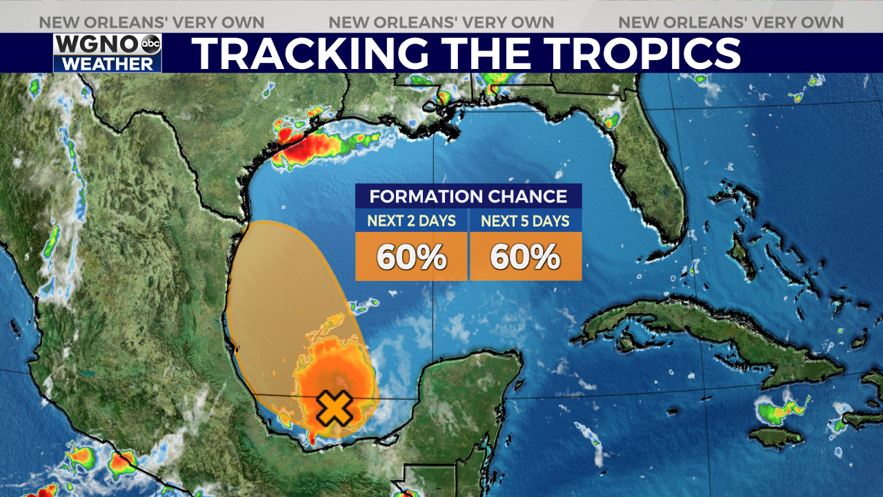
This system may become a tropical depression later today or tonight, but it will likely be short-lived due to its proximity to land. There just is small window of about 24 to 48 hours for development before the system moves onshore along the coast of Mexico or near the southern tip of Texas.
If it becomes a named storm, the next name on the list is Danielle. Regardless of development, this system is not a threat to Louisiana.


