The forecast for New Orleans and southeast Louisiana is still hot into sunset with very little rain keeping temperatures and feels like temperatures intense in the metro.
Stay hydrated. Highs, themselves, reached mid 90s again but felt more like 100s. Overnight, over both sides of Lake Pontchartrain, expect 70s.
Into your weekend, there’s the chance we see additional scattered downpours! 50% or 60% chances remain the theme. Tomorrow, showers for brief relief are a little more widespread as more than half of the area can expect rain. This week, most rain chances remain daytime heating driven throughout the hottest part of your day.
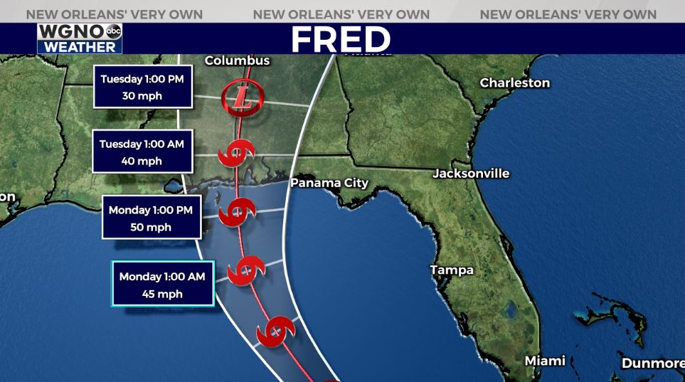
Fred is now no longer a tropical depression after moving off of land and into open water, but the forecast for intensity remains unchanged. The system will move west toward the Alabama, Mississippi border before making landfall as a tropical storm again Monday. All of the Mississippi Gulf Coast and parts of Louisiana’s coast are now included in the cone.
Windspeeds will likely be between 50 miles per hour and 60 miles per hour, but there’s the chance rapid intensification in the 24 hours before landfall could occur. Windspeeds much reach 74 miles per hour to be classified as a category one hurricane.
Tonight, we are watching this system to see if its center reorganizes. If the system redevelops a reorganized center early enough, a category one hurricane at landfall could be possible. The overall speed will likely slow down before landfall, too, to create potential flooding issues along and east of wherever Fred’s center tracks onshore before moving inland.
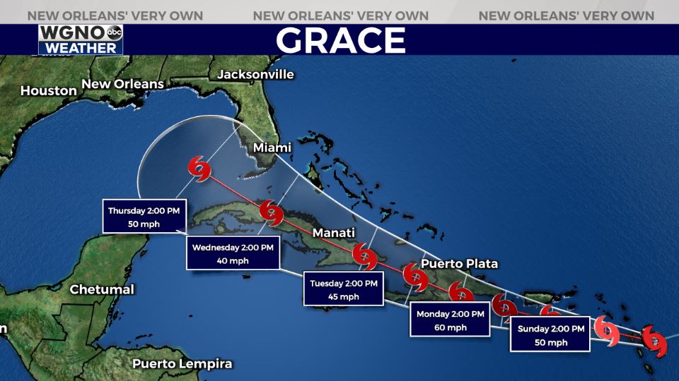
Tropical Storm Grace is behind Fred with a similar forecast for intensity. In the beginning, Fred’s path looked just like Grace’s right now. Over the past couple of days, Grace’s path has shifted considerably west, as well. We are watching both systems very closely for potential track shifts. This system has a lot of land to surpass, so we will watch to see if it can reemerge into the Gulf after coming off of Cuba. Right now, there are no concerns locally as both look to stay east of New Orleans and much of Louisiana’s coastline.
Join in for forecast updates and the latest track information on WGNO News at 10PM tonight.