
Seven ocean drones are being launched in the Atlantic Ocean and Gulf of Mexico to collect data inside hurricanes.
Conducted through a partnership with NOAA and Saildrone Inc., the launch comes just a few weeks ahead of the historical peak of Atlantic hurricane season activity.
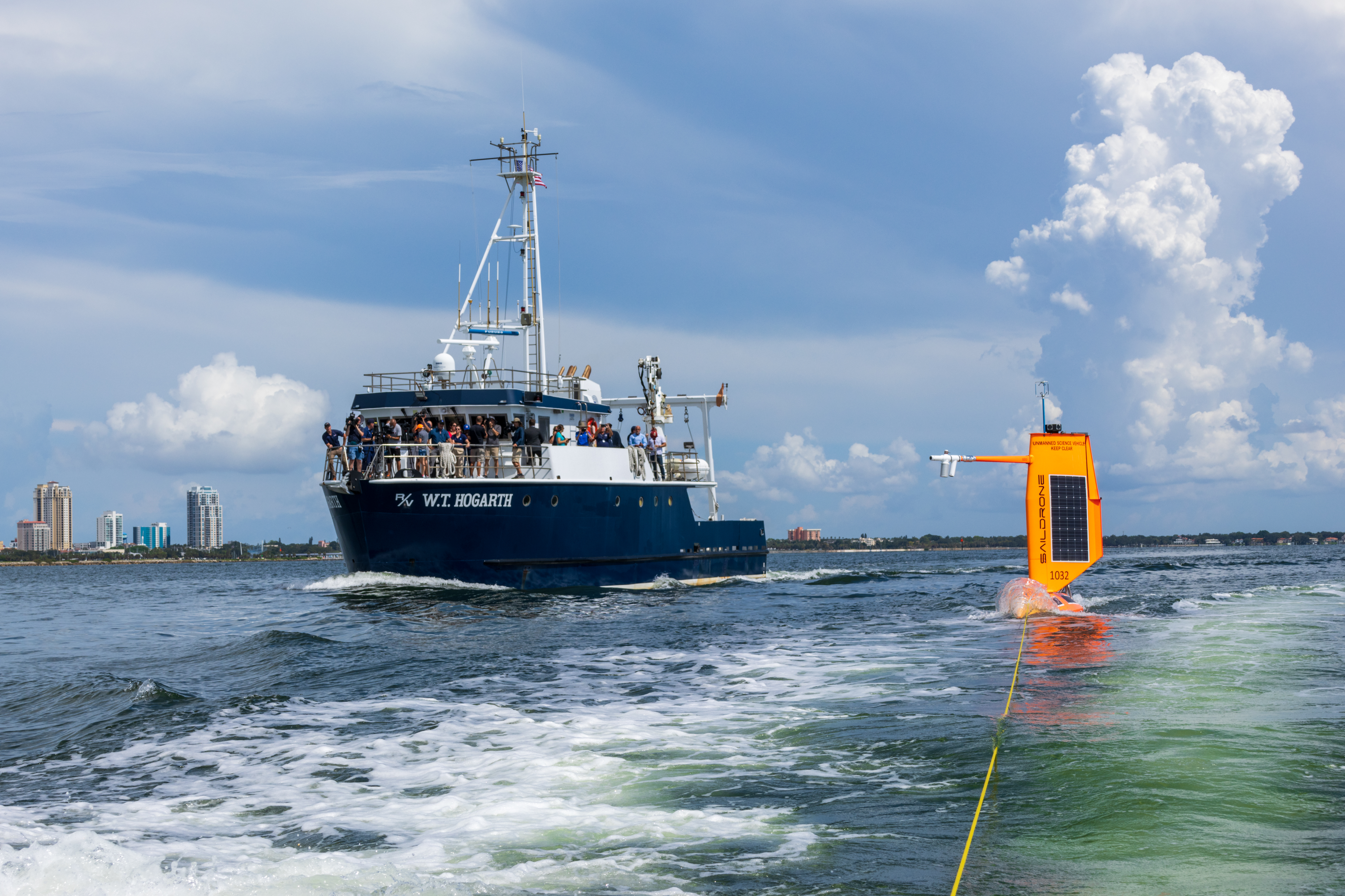
For the first time ever, two saildrones will track hurricanes in the Gulf of Mexico.
Two saildrones were deployed into the Gulf this week, one from St. Petersburg, Florida, and another from Port Aransas, Texas.
Five other saildrones were successfully launched this summer from the coast of Jacksonville, Florida and the U.S. Virgin Islands to survey the Atlantic Ocean and Caribbean Sea.
Data from saildrones and other uncrewed systems will help forecasters better understand the forces that drive hurricanes to warn communities earlier.
According to NOAA, one of the biggest challenges to hurricane forecasting is predicting rapid intensification, when hurricane wind speeds increase at least 35 mph over a 24-hour period.
In order to better understand how storms intensify, scientists will collect data on the exchange of energy between the ocean and atmosphere in the forms of heat and momentum.
“This season, NOAA will work with numerous partners to gather oceanic and atmospheric observations using a suite of platforms to monitor the conditions that play a role in hurricane intensity changes,” said John Cortinas, Director of NOAA’s Atlantic Oceanographic and Meteorological Laboratory (AOML). “Storms that intensify rapidly can cause extensive damage and loss of life and real-time observing systems are crucial to better understanding the atmospheric and oceanic processes that lead to the formation and intensification of these hurricanes.”
Saildrones are equipped with a special “hurricane wing,” which looks like a hard sail, to withstand the extreme wind conditions encountered in storms as they gather data from the near-surface ocean and atmosphere in real-time.
During the 2021 hurricane season, a saildrone collected critical data and the first ever video from inside a category-4 hurricane.
A recent study using that data from Hurricane Sam found that saildrone wind measurements taken from Hurricane Sam show excellent consistency with measurements from satellites and a moored buoy, providing confidence in the saildrone’s ability to collect accurate data in the harsh conditions of a major hurricane.


