NEW ORLEANS (WGNO) — Hurricane Ida blasted the Louisiana coast on Sunday, with the eye of one of the most powerful storms to ever hit the U.S. coming ashore near the barrier island of Grand Isle with violent winds of 150 mph (241 kph).
Ida’s landfall came on the same date Hurricane Katrina ravaged Louisiana and Mississippi 16 years earlier, about 40 miles (64 kilometers) west of where Category 3 Katrina first struck land.
WGNO meteorologists reminded people to hunker down in the most interior room of their home and away from windows.
The storm is expected to move across the southeast Louisiana wetlands, weakening only slightly, and to bring devastating weather to New Orleans and Baton Rouge.
Ida rapidly intensified overnight as it moved through some of the warmest ocean water in the world in the northern Gulf of Mexico.
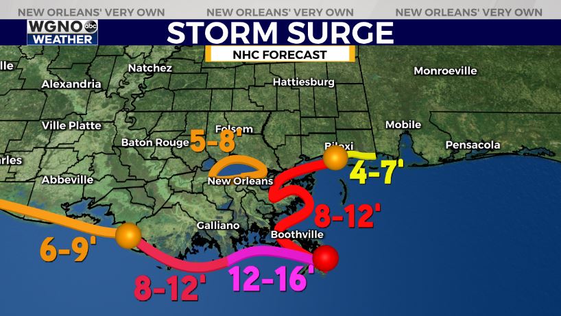
New storm surge projections for Ida include 12-16′ of inundation above normally dry ground from Port Fourchon to the mouth of Mississippi, according to officials.
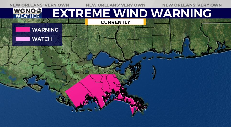
Power outages will be likely with 80-115mph gusts in metro New Orleans. Higher gusts are possible with any shift in the track closer to New Orleans, according to meteorologists.
From Baton Rouge to Houma to New Orleans to Slidell, you should be prepared for significant impacts. If you’re in low lying area that floods, we will have significant heavy rain & tornado threat in southeast Louisiana.


