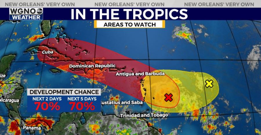
The tropical wave in the western Atlantic known as Invest 94 now has a high chance of development over the next 2-5 days according to the National Hurricane Center Monday morning. This wave will need to be watched closely as it moves to the northwest.
Showers and storms associated with the wave have become stronger and better organized overnight. There are signs of circulation within this cluster of storms and it’s possible a closed center is forming.
This is in the beginning stages and it is way too early to know where this is going or how strong it might be. However models are actually in pretty good agreement over the next few days.
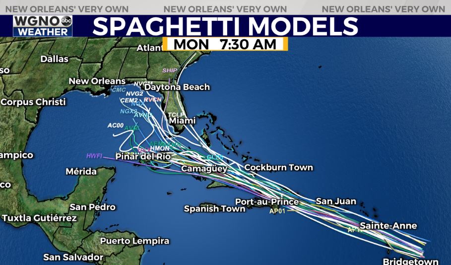
The spaghetti plot is tightly grouped through the next few days bringing the system over portions of Cuba by mid to late week.
After that there is some disagreement on whether this system enters the eastern or central Gulf or heads more up the east coast. Some of the large scale global models right now indicate a more eastward position.
Again it is way too early to know where this ends up going, but at the very least we need to watch it closely. Activity will likely continue to pick up over the next couple of weeks so have your hurricane preparations in place and ready to go.