
A hurricane watch has been issued for southeast Louisiana and southern Mississippi ahead of Tropical Storm Sally. Sally is forecast to move into the area late Monday with a threat of damaging winds, storm surge, and rainfall flooding.
Right now the forecast track continues to bring the storm near the Louisiana and Mississippi border. The strongest impacts will be felt east of the center putting most of the Mississippi coast in the cross-hairs along with parts of southeast LA.
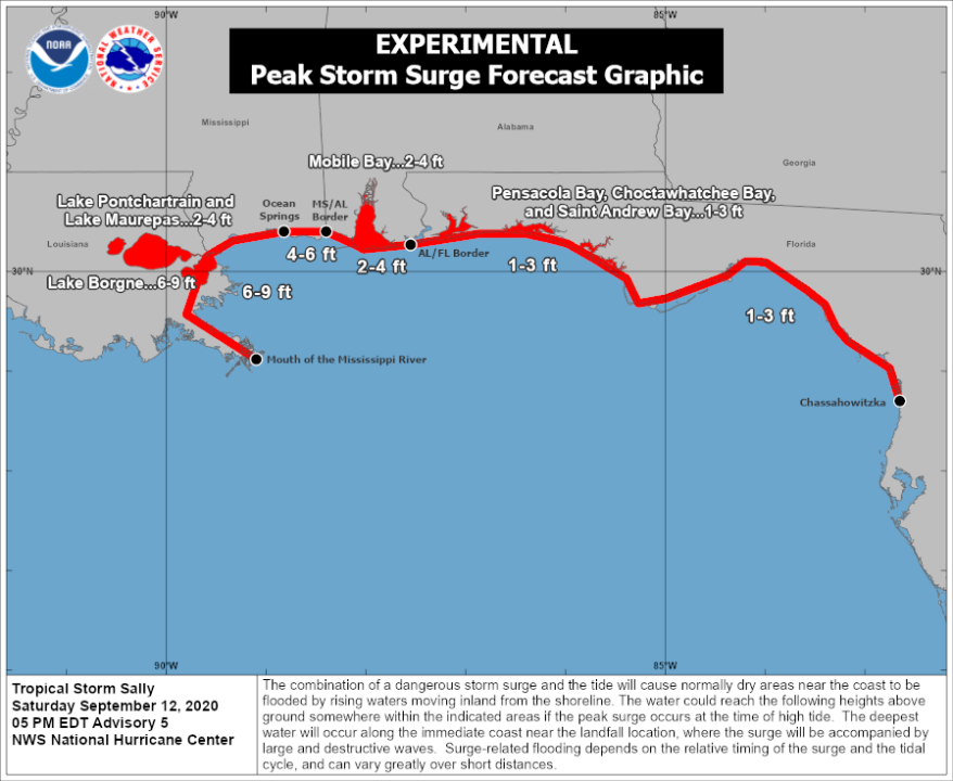
Storm surge potential of 6-9 feet according to the National Hurricane Center east of the mouth of the river, with lesser amounts farther east and for the lakes. This could be the biggest impact of storm surge in the last 15 years.
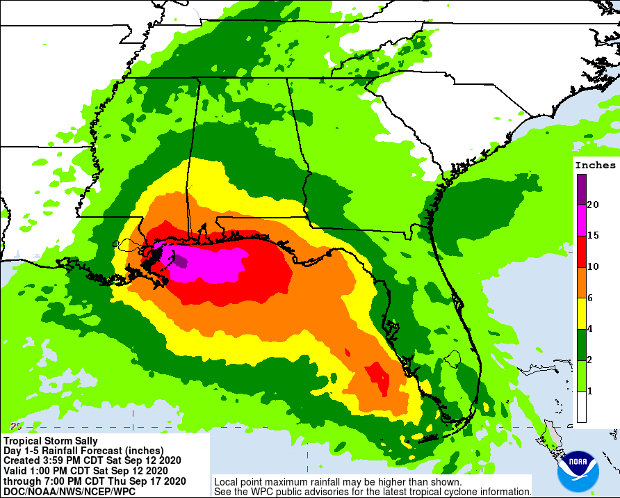
Rainfall flooding is also likely somewhere near and east of the center. Amounts of 10+ inches will be possible.
This is a situation that needs to be watched very closely. Go ahead and get supplies and be prepared for power outages. Move items inside the levee system from the coast.
Stay with WGNO for the latest.
Check out current conditions near you: https://digital-stage.wgno.com/weather/new-orleans-weather-radar/
Stay up to date with the latest forecast: digital-stage.wgno.com/weather/forecast/
Download the WGNO Weather App to stay connected this hurricane season


