We continue to watch the slow development of Invest 92L down in the central Gulf of Mexico. There have been some signs Thursday that a more defined area of low pressure is forming, but at the moment nothing in imminent. Either way, this system looks to stay very weak and disorganized which means the main impacts will be well east of the center.
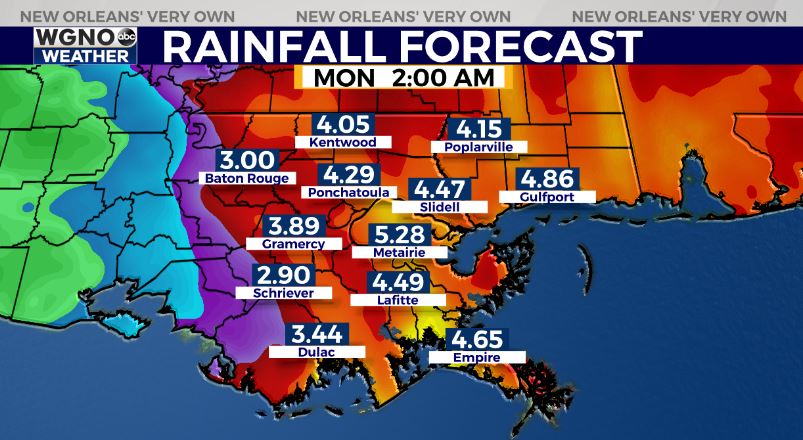
Heavy rain looks to be the main threat with this system. Likely not everybody sees the highest amounts and flooding, but some could. The better chance will be on the eastern side of the area, from New Orleans east to Biloxi. Some areas could see more than 6 inches through Sunday.
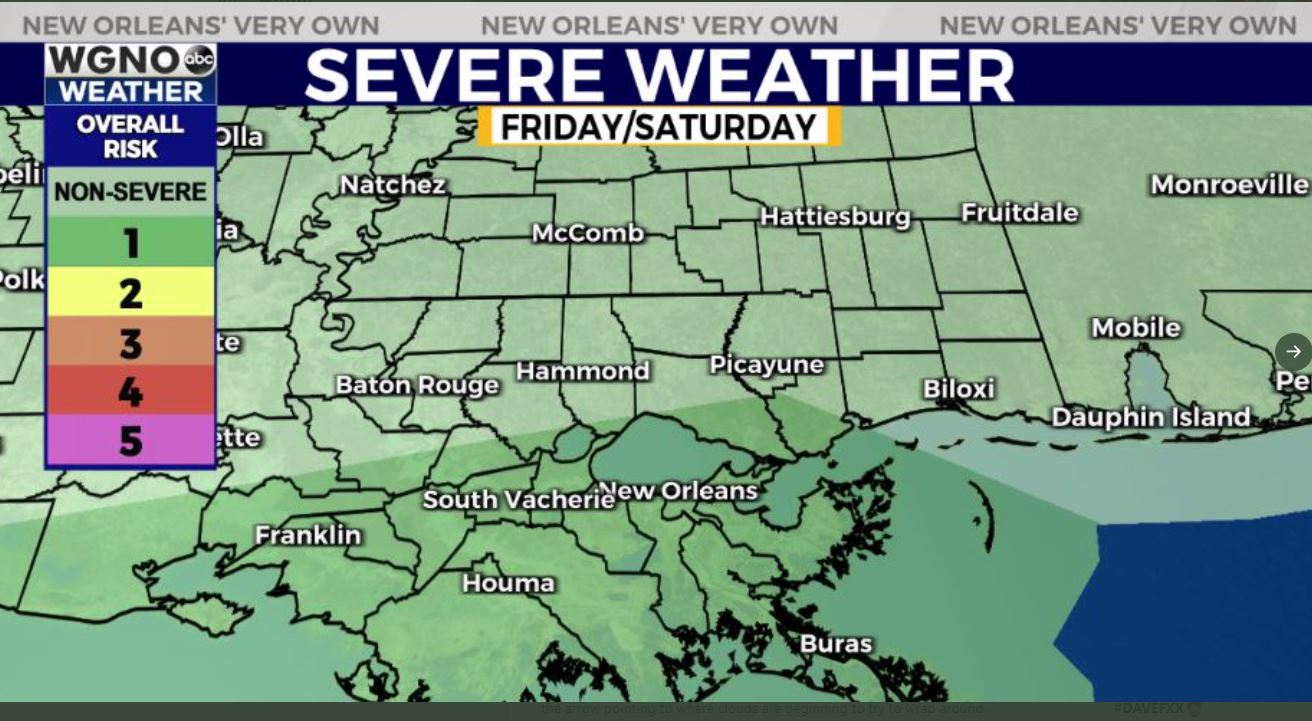
Other areas should stay below that range. As always isolated bands of heavier amounts will be possible. Also, as with any system, isolated tornadoes will be possible within the stronger cells. We have that low end threat from the SPC the next couple of days.
Storm surge levels should be low with a 2-4 foot above normal range. Winds will depend on intensity of the storm but gusts of 35-45 look possible. Isolated power outages could occur.