
Tropical Storm Fred continues to strengthen Monday morning with winds of 60mph as it makes its way towards the Florida panhandle. There is a large amount of dry air beginning to wrap around the eastern side which will likely keep it from getting to hurricane status.
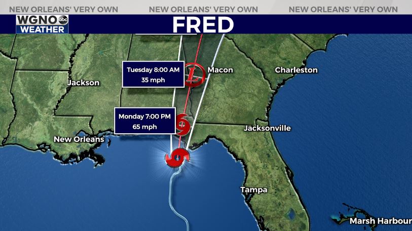
The strongest winds and storm surge will be on the eastern side of the center, although a large portion of the panhandle could get flooding rains as this moves north. Heavy rain and potential flooding will move well inland with the storm along with the risk of tornadoes.
After that we turn our attention to what is now Tropical Depression Grace. This system has been struggling to maintain its intensity over the past couple of days. All indications at the moment are that Grace will stay well south of the central gulf states.


