
Tropical Storm Fred continues moving north early Monday morning at 9 mph with winds of 50 mph. The center of circulation is now within radar range and you can see the bands of stronger storms trying to wrap around the center. It looks like this will continue to intensify up to landfall, and could get close to hurricane strength.
The track is pretty much locked in at this point with landfall coming likely near Panama City.
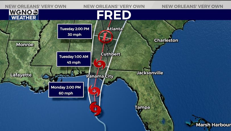
Strongest winds and storm surge will be on the eastern side of the center, although a large portion of the panhandle could get flooding rains as this moves north.
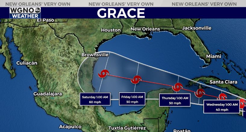
After that we turn our attention to what is now Tropical Depression Grace. This system has been struggling to maintain its intensity over the past couple of days. All indications at the moment are that Grace will stay well south of the central gulf states.
The tropics will likely remain active over the next few weeks. Have your hurricane preparations in place and ready to go if needed.


