Once again, the forecast for today across New Orleans and southeast Louisiana has been hot and humid with record-tying temperatures and sunshine.
Afternoon highs were, area-wide, reaching the mid 90s. Once the humidity factored, in, however it felt like the triple digits across southeast Louisiana. Overnight, over both Northshore and Southshore locations, expect 70s on both sides of Lake Pontchartrain!
Right now, strong storms are moving through our WGNO metro from the north, heading south with a gusty wind and hail threat. There are lots of lightning strikes and heavy downpours imbedded in these, and the Storm Prediction Center is issuing a level 2/5 Slight Risk across both sides of the lake. Late tonight we’ll see clearing before rain chances return much of this week. At that point, scattered activity cannot be ruled out with each day presenting about a 30% or 40% threat of showers through your upcoming week. Of course, this is going to mean temperatures rise into mostly low 90s! Typical forecasts for June!
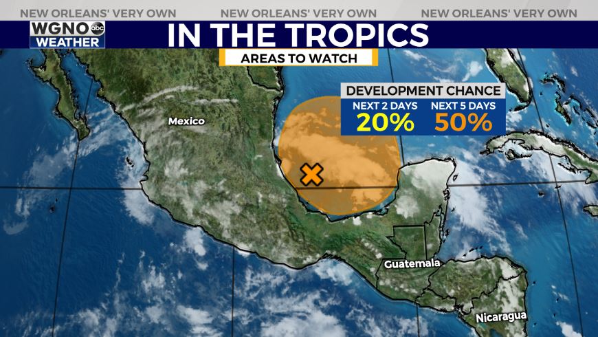
Right now, no immediate concerns amid open waters! These next 48 hours look calm as far as potential tropical development, but there is about a 20% chance for formation of this materializing low pressure system in the Bay of Campeche by early next week and a 50% chance by mid-week. We can keep a close eye on it, of course, but there’s no reason on being concerned yet!
Soak up these gradually warming temperatures while they last and keep up as more information in WGNO.com articles plus each newscast will be available the whole day today. Catch us live during WGNO News at 10PM!