Once again, the forecast for today across New Orleans and southeast Louisiana was hot and humid with near record-tying temperatures and sunshine.
Afternoon highs were, area-wide, reaching the low to mid 90s. Once the humidity factored, in, however, it felt like the triple digits across much of southeast Louisiana. Drink plenty of water and stay inside in air conditioning whenever possible.
Overnight, over both Northshore and Southshore locations, expect 70s on both sides of Lake Pontchartrain! Late tonight, we’ll see steady clearing before minimal rain chances return tomorrow to late Thursday. At that point, scattered activity cannot be ruled out with each afternoon presenting about a 20% or 30% threat of showers. Of course, this is going to mean temperatures rise into mostly low 90s! Typical forecasts for June!

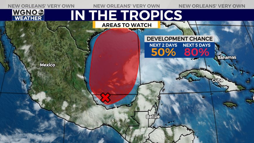
Right now, no immediate concerns amid open waters! These next 48 hours look calm as far as potential tropical development, but there is about a 50% chance for formation of this materializing low pressure system in the Bay of Campeche by mid-week and a higher, 80% chance by late week into your weekend. We are keeping a close eye on Invest 92-L, of course, but there’s no reason on being concerned yet! More than likely, a heavy rainfall and flash flood threat will set up along the Gulf Coast Friday and Saturday into Sunday as this system marches north. Rainfall totals will likely be between 5-10 inches in most spots with localized higher amounts possible and coastal flood concerns.
Soak up these mostly sunny days ahead while they last and keep up as more information in WGNO.com articles plus each newscast will be available the whole day Wednesday. Catch us live during Good Morning New Orleans!


