All watches and warnings associated with Tropical Storm Marco have been cancelled for our local area.
A Hurricane Watch is now in effect from Port Bolivar, Texas, to west of Morgan City, Louisiana. Hurricane force winds of 74+ miles per hour are possible within the next 48 hours.
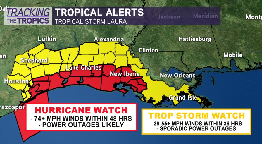
A Tropical Storm Watch is in effect from south of Port Bolivar to San Luis Pass Texas and from Morgan City to the Mouth of the Mississippi River. Tropical storm force winds 39-55+ mph winds possible within 48 hours.
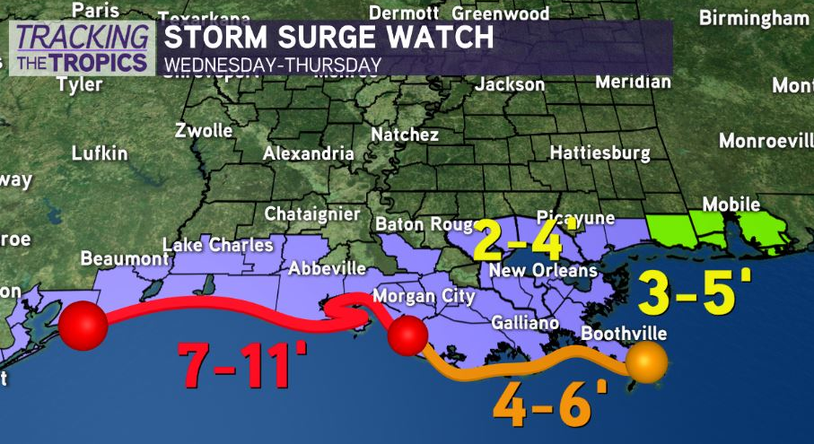
A Storm Surge Watch is in effect for…
* San Luis Pass Texas to Ocean Springs Mississippi
* Lake Pontchartrain, Lake Maurepas, and Lake Borgne
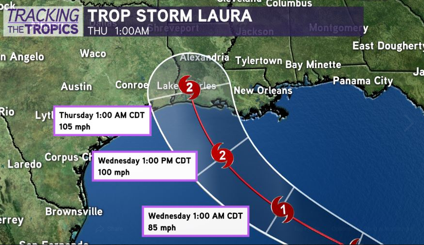
Afternoon model guidance is directly in line with the National Hurricane Center, showing a landfalling Category 2 or higher hurricane late Wednesday-Wednesday night.
Remember, average error in National Hurricane Center forecast track 2-3 days out is 75-90 miles. That means additional pivots in the track east or west are still possible. The window of time to prepare for a significant hurricane strike is dwindling, though.

There is an increasing risk of dangerous storm surge between 6-12 feet, damaging winds, and rainfall impacts from the upper southeast Texas-western Louisiana staring late Wednesday.
For Louisiana and Texas folks from Houston, Texas to New Orleans, Louisiana, have your evacuation plan ready to go, just in case you have to spring to action. Hurricane Watches will likely be issued for parts of Louisiana and Texas this evening, 48 hours in advance of the onset of hurricane force winds.
Stay vigilant! Even with the current projected path forecasting landfall in western Louisiana, southeast Louisiana could be beginning to see impacts by early Wednesday including coastal flooding, tropical storm force winds near the coast, localized heavy rain, and an isolated tornado risk.


