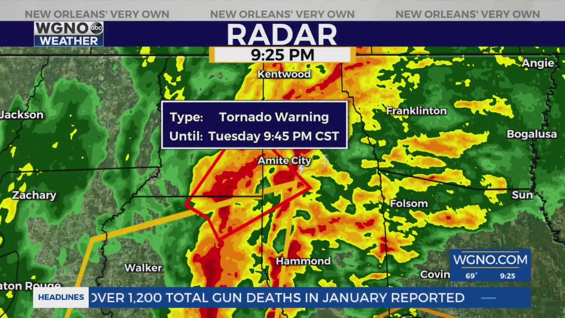
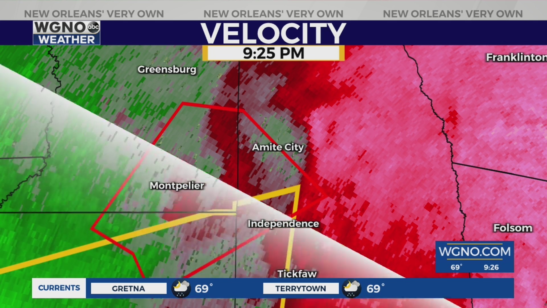
Tornado Warning in select parishes
We continue to monitor the storm heading east through Louisiana toward the Amite area of Tangipahoa Parish from the west. The west-central area of the parish remains under a Tornado Warning until 11:15 p.m.
Other areas now under the warning include:
- Jefferson Parish
- St. Charles Parish
- St. Tammany Parish
- Southwest St. Helena Parish, including the Montpelier area
- Northeast Livington Parish
Residents in the affected area are encouraged to take cover in the lowest level of an interior room in their home.
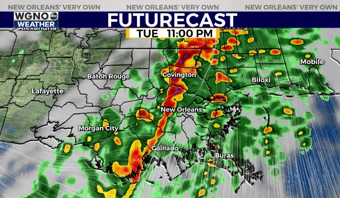
Tornado Watch for entire WGNO viewing area
Our entire viewing area remains under a Tornado Watch until 5 a.m. Wednesday. This includes the Louisiana parishes of:
- Jefferson
- Lafourche
- Orleans
- Plaquemines
- St. Bernard
- St. Charles
- St. James
- St. John the Baptist
- St. Tammany
- Tangipahoa
- Terrebonne
- Washington
This also includes Hancock, Harrison, and Pearl River counties in Mississippi.
The setup of this storm could bring with it a brief tornado touchdown, however, the storm could also produce rotation for prolonged periods of time with no touchdown. The rotation can bring with it strong gusts of wind along with possible wind damage. Expect this trend to continue through the night as it pushes east.
With the storm moving as quickly as it is, we can expect it to roll out of our viewing area by about 1 a.m. or shortly after.
Power Outages
As of 10:20 p.m. areas between Raceland and Mathews show having no power on the Entergy Outage Map. This appears to be the same just northwest of Laplace.
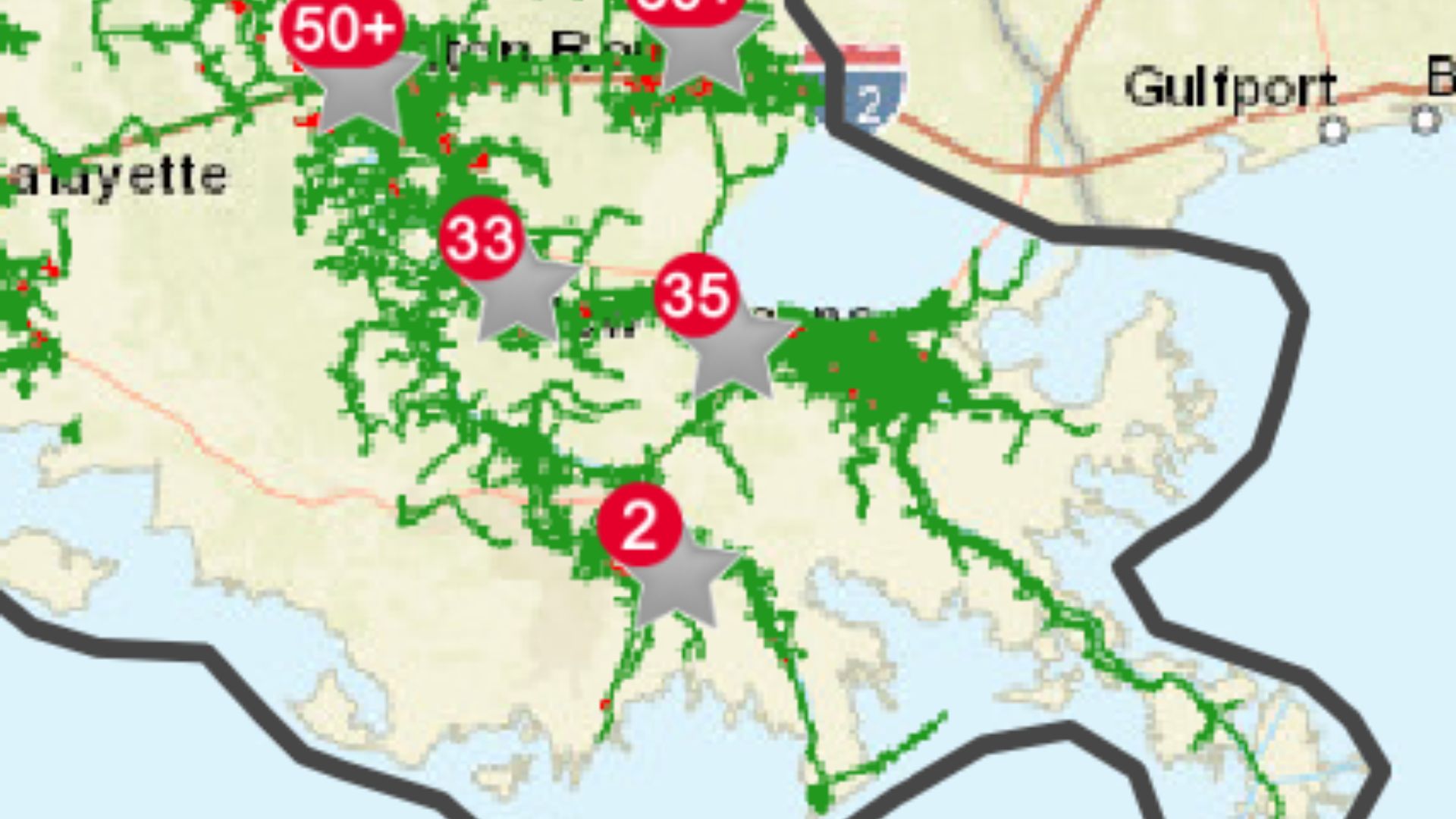
Here are some outage numbers by parish:
- Jefferson Parish – 295 outages
- St. John the Baptist Parish – 1692 outages
- Tangipahoa Parish – 1411 outages
- Terrebonne Parish – 402 outages
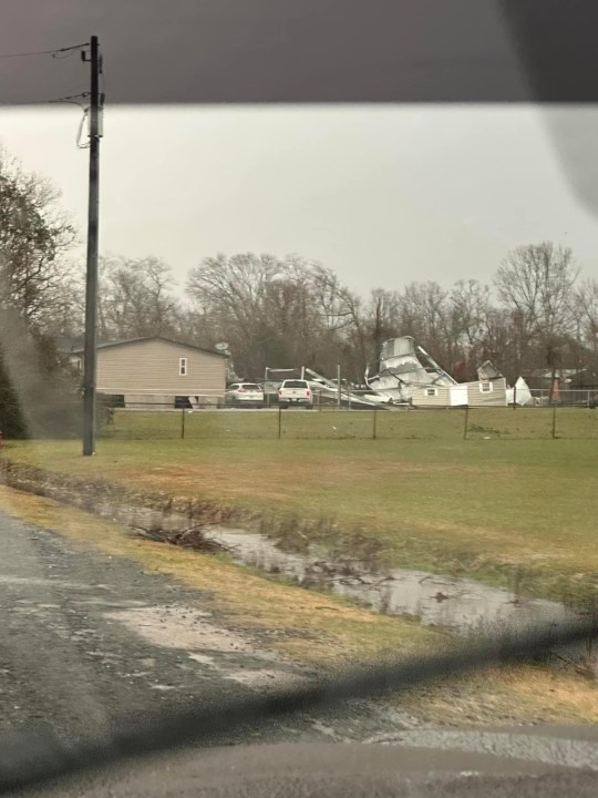
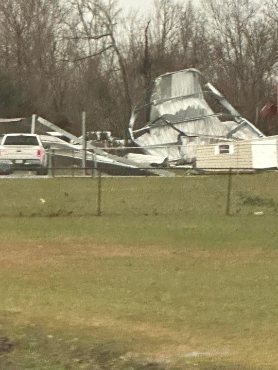
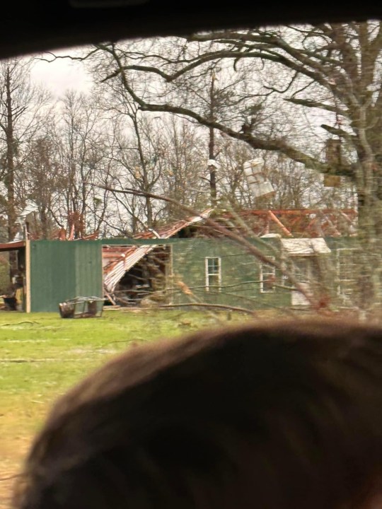
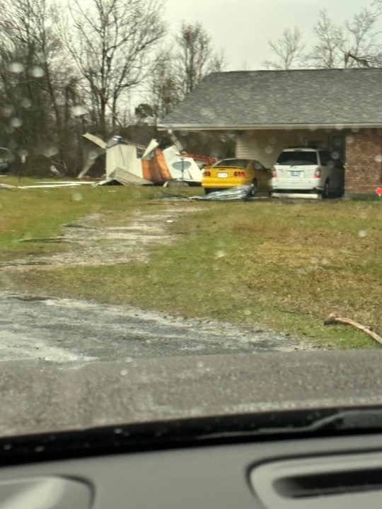
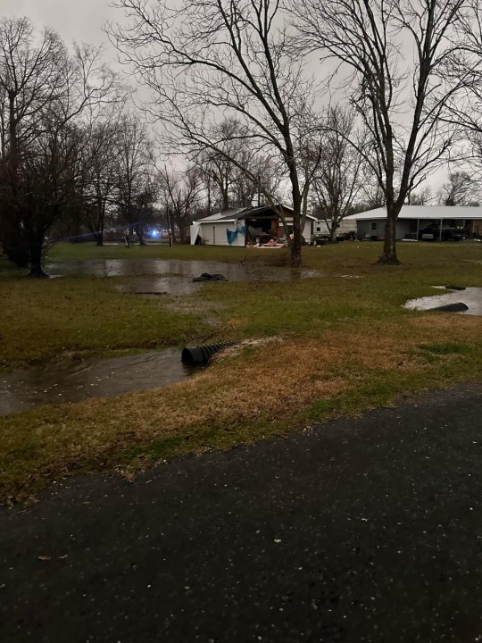
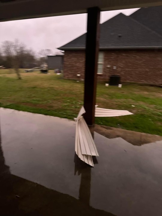
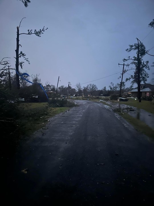
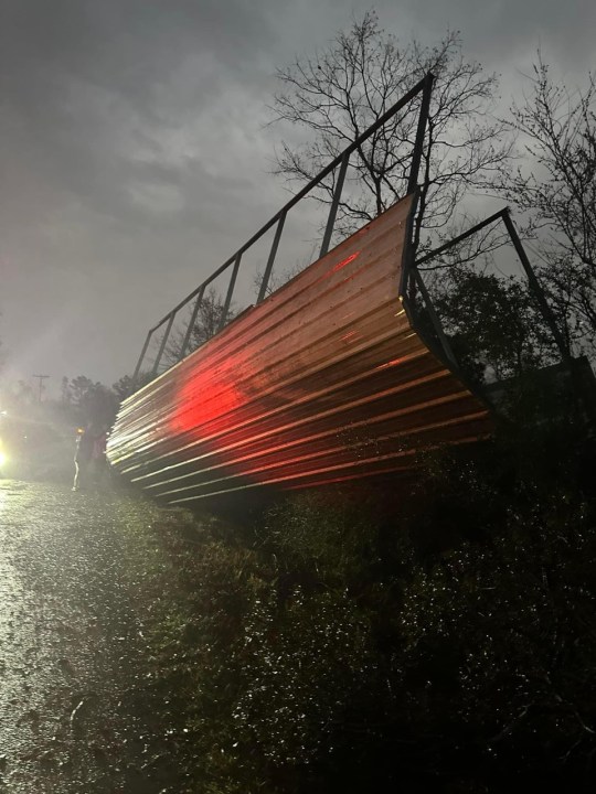
Reported Storm Damage

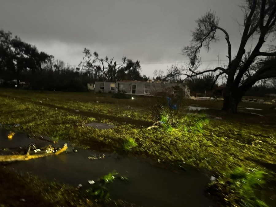
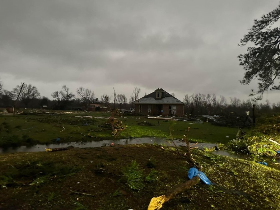
The Storm Prediction Center has placed most of Southeast Louisiana and South Mississippi under an “Enhanced Risk” for severe weather, which is threat level 3 out of 5 on their scale.
Stay alert to weather conditions this evening and have a way to receive warnings if they are issued for your area. If you are under a warning, get in a safe place until the storm has passed.
Stay updated with the latest news, weather, and sports by downloading the WGNO app on the Apple or Google Play store and subscribing to the WGNO newsletter.


