
A tornado watch is in effect until 8PM Thursday for the northern parts of the area. This includes Tangipahoa and Washington parishes along with Pearl River county.
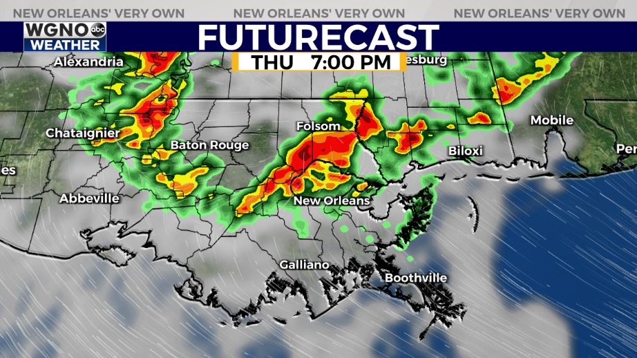
A cluster of storms moving through western Mississippi will continue to move to the east and southeast through the afternoon and evening. Forecast models show this line moving into areas north of I-12 by this evening.
This system will have the chance to produce gusty winds along the leading edge of the storms and perhaps an isolated tornado or two. It does look like it will be weakening as it moves through the area. Stay alert to conditions this evening, especially if you live north of I-12, and have a way to get warnings if they are issued.
After today we see rain chances start to go down. Look for a few isolated storms Friday around 30% and then only spotty coverage over the weekend at 20%. It will be hot and humid through the weekend with upper 80s.