
Our forecast for Sunday’s playoff game could be the WILD CARD, itself, as a wintery mix potentially threatens some parts of Louisiana!
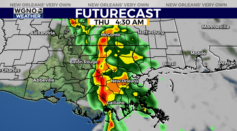
This week, we have two cold fronts marching in: number one on late Wednesday, early Thursday and number two Sunday.
Overnight, most storms will be below severe limits, passing through around daybreak then ending shortly, thereafter.
Come Gameday, you will probably want to watch kickoff inside in warmth!
As far as wintery precipitation on the ground, remember, it is always rare and very tough to get the ingredients for snow along our Gulf Coast.
The system from Sunday night through Monday continues looking interesting in several ways. This cold front will merge with another developing low-pressure system off of the coastline.
Here are a few questions impacting our forecast outcome. Will air be becoming cold enough, and if this is cold enough, will there be enough moisture? For forecast areas spanning Northshore parishes into south Mississippi, a brief switchover from rain to sleet or flurries does appear possible.
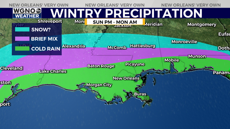
Nonetheless, no impacts are expected. Based off of the current forecast, Southshore residents likely will not see anything collecting. At best, anticipate a few sleet pellets mixing in early morning without impacts. This is still 4 to 5 days away, so something you should check back on as your week progresses! Who Dat?!


