Good Morning, New Orleans!
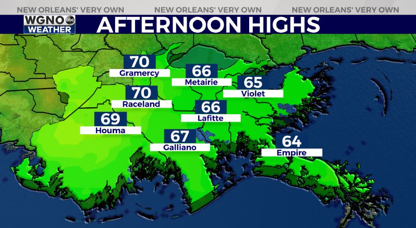
Happy Tuesday! Our forecast for the upcoming week is going to be beautiful through Wednesday! Right now, we are a bit warmer than we were 24 hours ago. Afternoon highs will reach mid-60s to 70s, but we started out in 30s or 40s, so bundle up. Layers will be best.
Enjoy this forecast for mostly sunny conditions and a bit more warmth through mid-week. Temperatures fall again looking to your weekday mornings. Wall to wall sunshine will help make it feel warmer, but you have to dress properly! Layer up!
This afternoon, we top out in the 60s before yet again upper 50s or 60s for highs return into your weekend. Overnight, the 50s will return across both sides of Lake Pontchartrain and most spots south will flirt with 30s just above freezing again by Saturday. Tomorrow morning, we’ll likely Rain chances are no longer in the forecast for 24+ hours to come. They do return late Wednesday and Thursday as yet another front approaches. Severe weather is going to be possible at that point, so have ways to receive warning information on hand.
Have a lovely day today and night tonight! We have more information on WGNO News at 11AM!