5:30PM– The risk of flooding continues to subside across the area Tuesday evening but the rain is not done. We will see showers and a few storms continuing to move through until just after sunset. At that point most of the activity tapers off and we will be looking at only a spotty shower or two overnight.
The Storm Prediction Center has placed most of Southeast Louisiana under a “Marginal Risk” for severe weather, which is threat level 1 out of 5 on their scale, through Tuesday evening.
Scattered showers and thunderstorms this afternoon may produce locally heavy rainfall, damaging wind gusts, and hail.
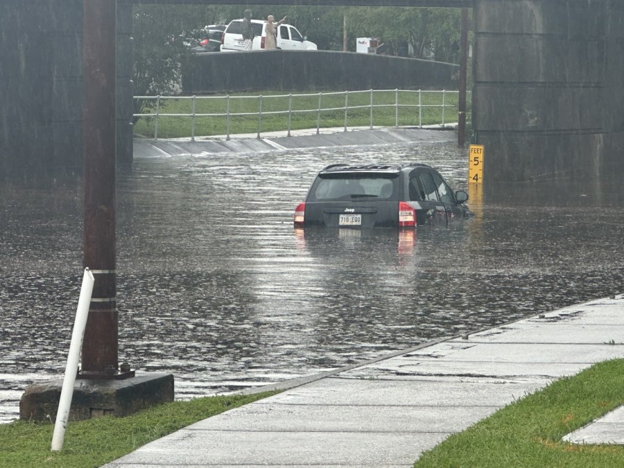
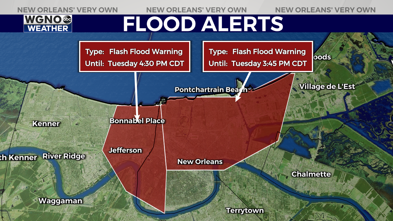
Flash flooding is ongoing near the Lakefront Airport, Gentilly, and New Orleans East. Around 1 to 2 inches of rain have fallen in the last hour, and another 1 to 2 inches can be expected.
Two people were seen being rescued from a submerged vehicle at Canal Boulevard and Homedale Street in the Mid-City/Lakeview area. No injuries have been reported as a result of the flooding.

Another Flash Flood Warning is in effect for western Orleans Parish and northern Jefferson Parish until 4:30 p.m.
The City of New Orleans has lifted Neutral Ground Parking restrictions until at least 9 p.m. Tuesday due to the threat of heavy rainfall and street flooding.

The following streets are flooded reportedly flooded:
- Ponchartrain Blvd/12th St.
- Filmore/ General Haig St.
- Allen Toussaint Blvd/ Marconi Drive
- 6000 Chef Menteur Hwy
- 5000 Louisa Dr.
- Canal Underpass (Closed)
- 6000 Chef Menteur Hwy
- 5000 Louisia Drive
- Skyview Dr./Ransom St.
- Crowder Blvd./N I-10 Service Rd.
- 6800 Tara Ln.
- 10200 Curran Blvd
- Chef Menteur Hwy/ Downman Rd.
- 5700 Crowder Blvd
- Elysian Fields/ Filmore Ave.
- Downman Rd. / Hayne Blvd.
Storms are expected to remain in the area for the next several hours, with rain chances dropping gradually after sunset.
Stay with WGNO on air and online for the latest updates.
Stay updated with the latest news, weather, and sports by downloading the WGNO app on the Apple or Google Play store and subscribing to the WGNO newsletter.


