An area of low pressure will move out of Texas and east across the lower Mississippi valley Monday night into Tuesday and bring another round of locally heavy rain and storms to our area. There will also be a low end chance of severe weather with this system.
The upper low actually swings farther south than a lot of system and will move across central Mississippi. Rain and storms will develop ahead of that by later tonight and sunrise Tuesday.
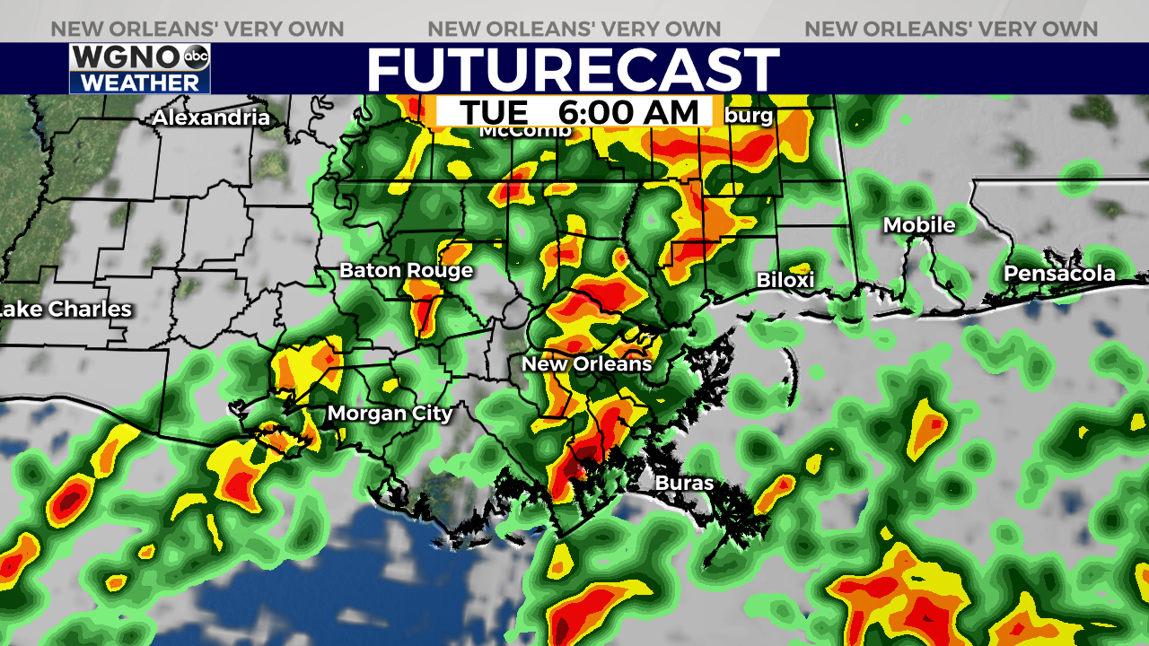
Currently the Storm Prediction Center has our area under a level 1 threat outlook for this storm system. The biggest impact would likely be a strong wind gust within a storm, but an isolated tornado or some hail can’t be ruled out. Expect very heavy rain with the stronger storms as well and this will impact the morning commute Tuesday.
After that we will see nicer weather Wednesday and Thursday with another round of rain and storms coming in early on Friday.


