Our next big cold front will be moving through on Wednesday. This will bring a line of storms with it that could produce severe weather. The Storm Prediction Center has us under an Enhanced Risk (Level 3 out of 5) threat for severe storms.
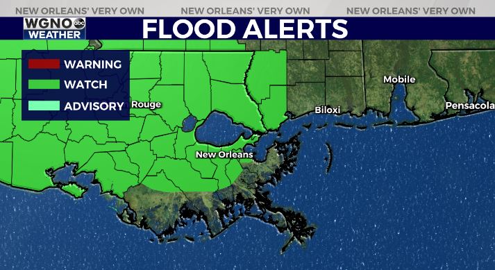
This means isolated tornadoes will be possible along with gusty winds, so prepare for all forms of severe waether. There will also be the chance for heavy rain, and a Flood Watch is issued starting Tuesday night.
There will be the chance for a few showers or storms later tonight but right now that looks spotty. It seems that most of the rain will hold off until Wednesday morning or even later depending on the timing. The slower movement will mean a bit lower severe threat but a higher threat of street flooding.
Once that front moves through we will see much cooler weather push in. Highs will go from the mid to upper 70s through Wednesday to only in the mid to upper 50s by Thursday and Friday.
Stay aware of weather conditions Tuesday night and Wednesday and have a way to get warnings if they are issued.


