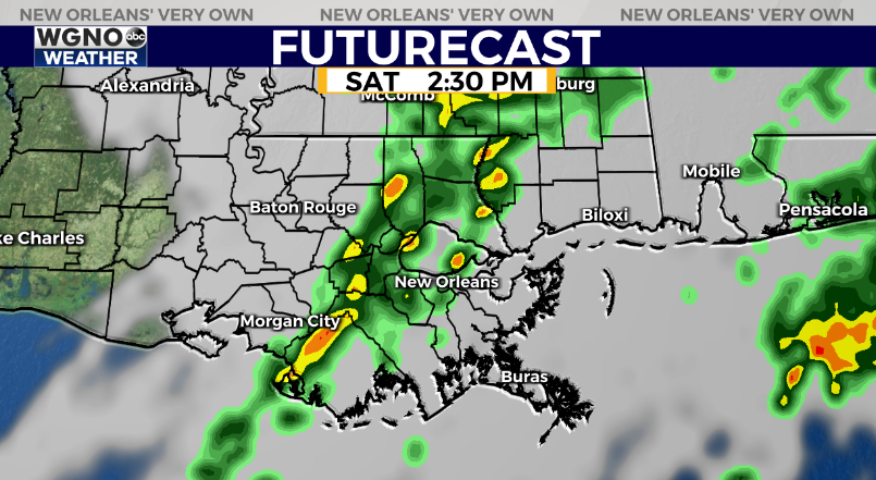
A strong cold front is on the way Saturday and that will put an end to the nice weather of the past couple of days.
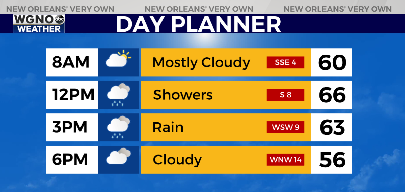
Look for warmer temperatures tonight with lows only in the low to mid-50s for most of the area. Saturday temperatures will depend on the timing of the cold front.

Most of the area will see at least the mid to upper 60s. If the front is a bit slower, or areas to the east where it takes longer to reach, you could see low 70s.
Expect spotty showers early in the day with the main band of rain moving across the area in the early to mid-afternoon time frame.
Once that happens cooler air will begin to filter in.
Expect windy conditions with falling temperatures by Saturday evening. Lows will drop all the way into the 30s Sunday morning.
As the main upper-level system moves across the region most of the precipitation will be gone.
However, there could be enough left over for a few snowflakes or brief snow showers in the northern areas closer to the MS border.
Sunday will be windy and cold with most of the day in the 40s. We will clear out by Monday.


