Look for pleasant conditions overnight as temperatures drop into the low to mid 50s across the area. We might see a little coastal fog early Wednesday before the wind picks up.
Wednesday will be a warmer and breezy afternoon. Temperatures will quickly jump into the low to mid 70s tomorrow as winds pick up out of the southeast at 10-20. Expect more clouds over the area with a chance of a spotty shower. Anything that develops will be light and move through very quickly, and the rain chance overall is only around 20% for the day.
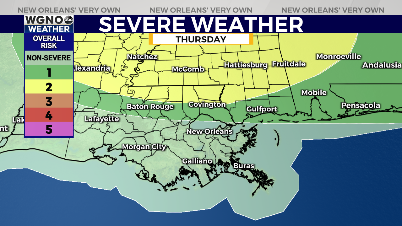
The main story of the week is a cold front moving in on Thursday evening and night. We will see very warm and windy conditions ahead of the front with mid to upper 70s. Look for a line of storms later in the afternoon through the evening moving across the area. There is a chance some of these storms could be strong to severe and the Storm Prediction Center does have a low end risk outlook for the northern areas.
After that we will see much cooler weather on Friday so the parades will be on the chilly side. The good news is it will be dry through the weekend and overall pleasant Saturday and Sunday.


