Happy Thursday as a warmer one continues across southeast Louisiana. Another cold front races to town bringing possible severe threats over this afternoon, then the arctic blast starts. We have another one on its way shortly. A Dense Fog Advisory was issued for much of the area until 9AM. Remember, your low beams are best during foggy conditions.
Enjoy this warm forecast for your morning before temperatures fall again looking to tonight.
Another front will arrive to town, bringing storms through from now until this afternoon before much colder air filters in Thursday night. We top out in the 70s before temperatures plunge.
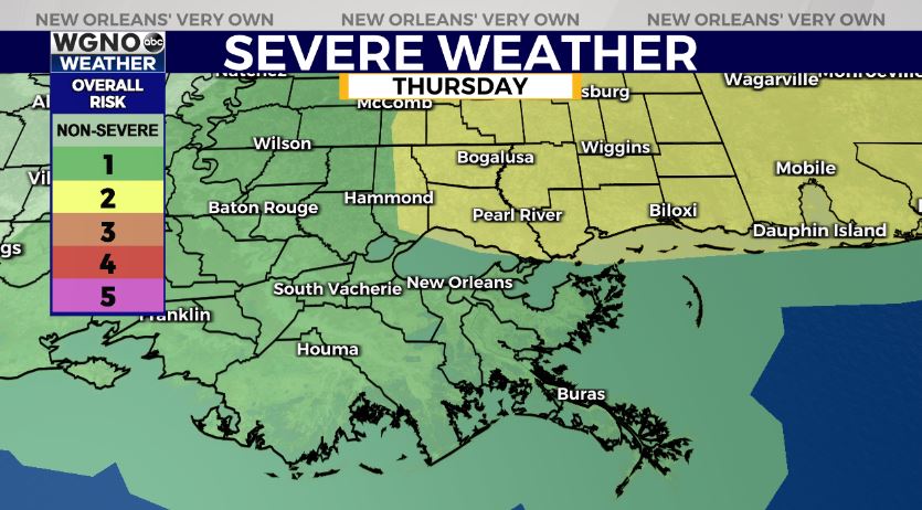
The Storm Prediction Center is issuing a Marginal Risk (Level 1/5) for severe weather. The Slight Risk (Level 2/5) has expanded east, as well. Have ways you can receive warning information on hand.
Gusty winds are a guarantee as a line of storms races through. Behind it, rain moves east and much colder air takes over. Overnight, the 30s will return across both sides of Lake Pontchartrain and most spots will flirt with 30s just above freezing again.
We’ll have more information on WGNO News at 11AM!


