This is an archived article and the information in the article may be outdated. Please look at the time stamp on the story to see when it was last updated.
A few showers may linger tonight but most of the activity will taper off. It will stay very warm and muggy with temperatures only dropping into the mid to upper 70s.
Friday we will watch the potential for a cluster of storms to move across the area. That cluster will produce more widespread rain and storms and also a better chance of severe weather.
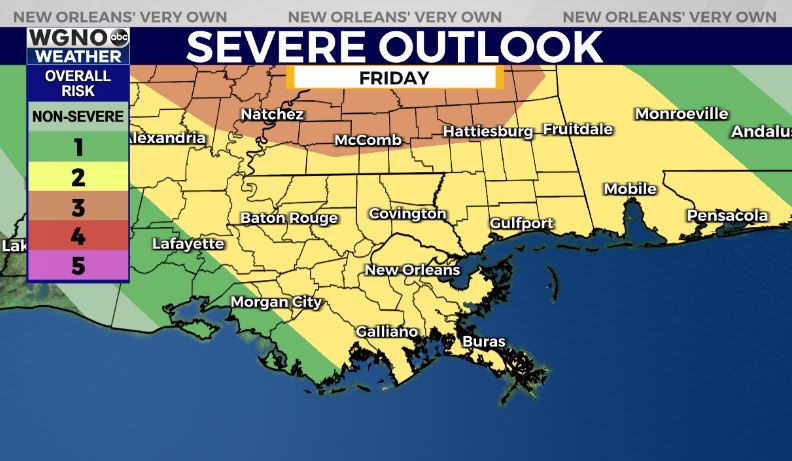
We could see strong wind gusts along the leading edge as that moves in along with very heavy rain. Right now we have a level 2 threat of severe weather from the SPC through Friday.
Temperatures will still warm into the low 90s for most of the area ahead of any rain that develops. Look for that trend over the weekend before dry weather moves back in heading into early next week.


