For the rest of Monday afternoon, temperatures will be a little warmer than what we would normally see this time of the year. Expect highs to reach the mid 80s with a mix of sun, clouds, and possibly an isolated shower.
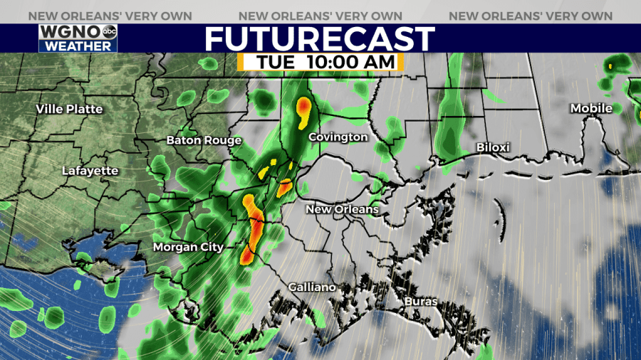
In addition to the temperatures increasing, humidity will be on the rise as well as moisture pulls into the region from the Gulf ahead of our next cold front. As the front approaches Tuesday, rain chances rise to about 60 to 70 percent.
There are still some questions on the timing and strength of this next system, but it appears that some of the storms could bring gusty winds and localized heavy downpours. The Storm Prediction Center has outlined most of Southeast Louisiana and South Mississippi with a “Marginal Risk” for severe weather, which is level 1 out of 5 on their scale.
Sunny skies return by the next morning along with cooler and drier air. Highs will top out in the low to mid 70s both Wednesday and Thursday. Our next cold front (and rain chance) will come Friday into Saturday.