Good Morning, New Orleans! We woke up today to mugginess and a bit of fog as our next front approaches.
A Dense Fog Advisory was issued for St. Tammany and Washington Parishes as well as Hancock County until 8 a.m. with visibilities below a mile.
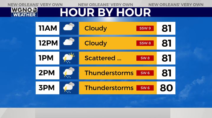
Right now, storms are on the radar, and a few more rounds will come through later today. Daytime highs will still remain in the low to mid 80s. Overnight lows will still range from the low to mid 60s north and south, too. We see humidity values briefly rise today before quickly falling. A weak cold front will come through tonight to early Thursday to bring humidity down all the more. Once it passes, we’re back to this week’s early pattern of high pressure dominating with quiet conditions!
Our forecast for southeast Louisiana and the Mississippi Gulf Coast will be lovely.
Tropical Storm Karl formed Tuesday afternoon in the southwestern Gulf and Bay of Campeche. This system is from the area of potential development we have watched the past couple of days moving across the Yucatan. It is actually part of what was Julia that broke off and moved northwest.
Karl will continue to meander around the southwestern Gulf through the week before moving inland along the central Mexican coast. This will not be a threat to our area or anyone in the northern Gulf.