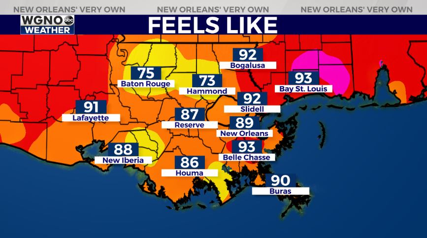
Once again, the forecast for today across New Orleans and southeast Louisiana is steamy with humidity and a few storms keeping temperatures lower across both sides of Lake Ponchartrain! Feels like conditions are now ranging between the upper 70s and mid 90s, depending on where rain in our area has cooled spots down.
Afternoon highs are, area-wide, reaching the upper 80s. Overnight, over both Northshore and Southshore locations, expect 70s on both sides of Lake Pontchartrain.
All day today into tonight, there’s the chance we see additional rain chances! Scattered activity cannot be ruled out with about a 60% threat of showers. Watch for localized heavy downpours that could lead to street flooding in some areas, much like we were seeing earlier.
Of course, this is going to mean temperatures rise into mostly upper 80s or low 90s by mid-week next week, feeling much hotter! Typical forecasts for late June!
Right now, no immediate concerns amid open waters! These next 48 hours look calm as far as potential tropical development Watching just one tropical wave off of Africa’s coast with minimal chances for organization on satellite plus another off of the East Coast!
Keep up as more information in WGNO.com articles plus each newscast will be available the whole day today. Catch us live during WGNO News at 5PM and 10PM!