Rain will be tapering off as it moves north over the next few hours. Most of the night will be mild with 60s and muggy. The cold front will be moving into the area by mid to late morning and early afternoon on Thursday.
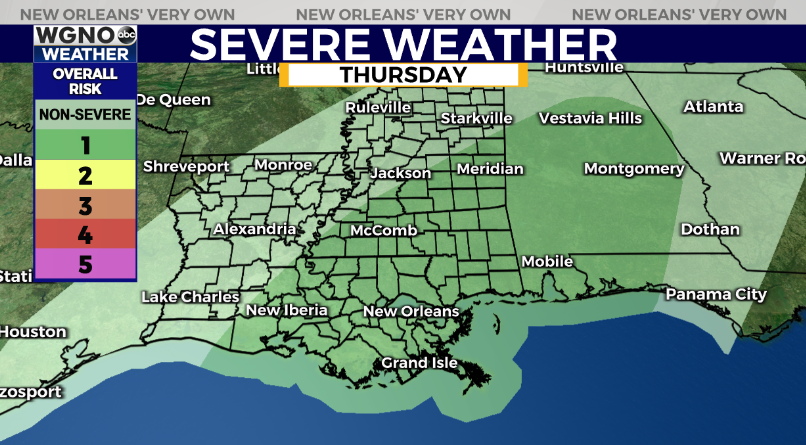
Expect rain and storms to develop as the front moves in. There is a chance some of these storms could be strong to severe, and the Storm Prediction Center currently has us in the level 1 out of 5 threat for severe weather. Strong to severe wind gusts with an isolated tornado will be possible. Have a way to get warnings if they are issued for your area.
The other big story will be the temperatures behind the front. We will go from the mid 70s Thursday to only the mid to upper 40s on Friday afternoon. Winds will pick up out of the north behind the front as well making Friday a very cold and wintry day. Expect rain to last through Friday morning even as the front moves offshore.
After that the weekend looks dry but chilly with highs only around 50 Saturday and mid to upper 50s Sunday. Lows will be around 30 to the north both mornings with mid 30s to the south.