Following a beautiful weekend, we have warmer, more humid days ahead.
After “springing forward” for Daylight Saving Time early Sunday, the sun will start to rise and set later.
High pressure continues dominating southeast Louisiana through early this week ahead yet another weak low pressure system making its way east from the west.
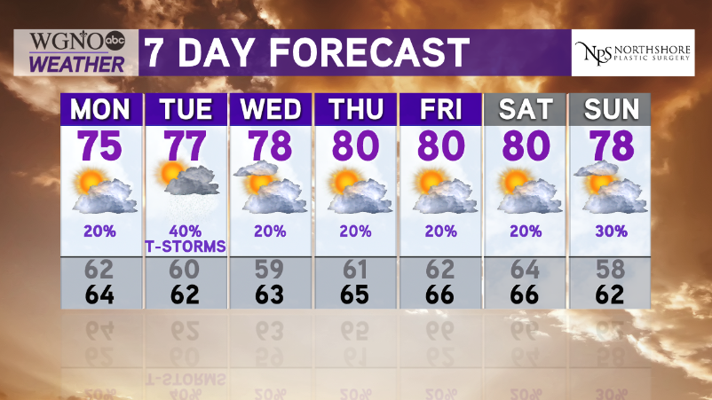
Expect an increase in moisture off of gulf waters, too, supporting the highest rain chances on Tuesday.
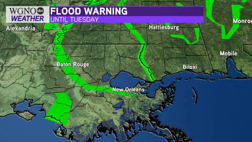
By Wednesday, Mississippi River levels should fall below flood stage, which is 17.00 feet. At that point, current warnings in effect for St. Bernard, Plaquemines, and Jefferson Parishes will likely expire. Local levees protect surrounding land from up to 20.00 feet of water.
High temperatures will be between the mid 70s to low 80s while low temperatures will remain in the upper 50s and 60s with low rain chances!
Luckily, next weekend’s St. Patrick’s Day parade weather looks fantastic!