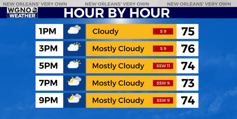
Temperatures are already beginning to warm up on the south shore Thursday morning and that trend will continue through the day. Look for a warmer day with highs back in the mid 70s. We will stay warmer tonight with low to mid 60s around the area.
Spotty showers will be developing through the day but will be small for the post part. These will be moving quickly through the area and it shouldn’t rain for very long in any one spot. These will also be hit or miss so there is not going to be rain everywhere.
Friday will be very warm ahead of the Saturday cold front. We will see highs in the low 80s Friday afternoon. The front looks to come through around midday on Saturday.
Expect a line of showers and storms as that moves through. Right now the threat for severe weather is low with this system and we currently have a level 1 out of 5 risk from the Storm Prediction Center.
After that look for cooler and drier weather on Sunday.