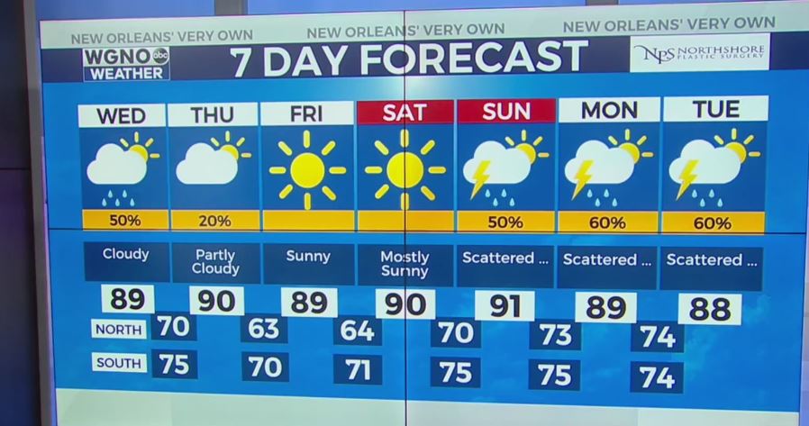
The tropical wave in the Gulf is producing a lot of rain and bringing moisture north but most of it is already getting pushed to the east of our area.
There is still a chance for showers and storms today but the coverage should be much more isolated than the past few days. Look for the best rain chance to be south of New Orleans and also along the Mississippi coastal counties. Any storms that develop could still produce locally heavy rain and lightning.
The low in the Gulf now has a 50% chance of developing into a tropical system over the next 2-5 days. Any development though will stay well off to our east.
We will see a lot of cloud cover so temperatures will stay in the mid to upper 80s through the afternoon.
By Thursday the front is pushing through. This will drop dewpoints from the mid 70s to the upper 50s and low 60s. That means much drier and more comfortable air. Afternoon temperatures will still be hot around 90 but overnight lows will be mainly in the 60s outside of the metro New Orleans area.