Thursday continues to look like the one problem spot for the rest of the Carnival season. Look for another warm and breezy day in the mid 70s with some spotty showers through the afternoon.
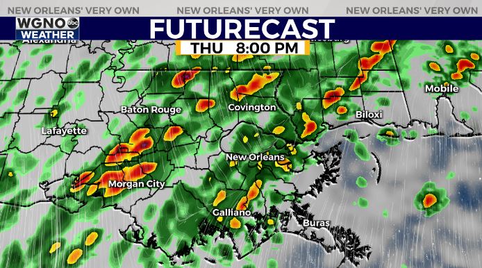
The main area of rain moves in Thursday evening as a cold front begins to move in. This will likely impact Thursday parades, especially the second half. Right now the SPC does have us in a low end risk outlook for severe weather so stay alert.

However this chance looks to be small, and we will likely be dealing with general rain and storms. Be aware that lightning could still pose a dangerous risk however.
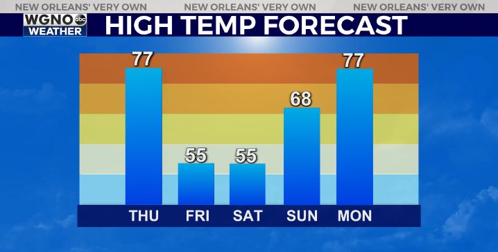
After that we get breezy and much colder behind the front. Temperatures Friday will only top out in the low to mid 50s. Saturday morning will see lows in the 30s across the area followed by another day with highs only in the mid 50s. Sunday looks nice with mid to upper 60s and then we are quickly back in the 70s on Monday.


