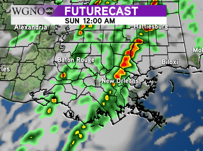
A strong storm system moving through the middle of the country Saturday will bring the threat of severe thunderstorms to the lower Mississippi River Valley. The Storm Prediction Center currently has all of southeast Louisiana and southern Mississippi under a ‘Slight Risk’ outlook. Keep in mind this still represents ingredients favorable for severe weather, even though the higher risk is farther north along I-20 in the state.
If you have students attending college in the northern part of the state you’ll want to make them aware of the potential dangerous weather.
The timing of this system will be later Saturday and Saturday night. A cold front will be moving through the area with locally heavy rain and strong winds. The threat of an isolated tornado is there as well similar to the system we saw last weekend on Sunday.
 The Futurecast shows the main line of storms coming through the New Orleans area around midnight. Timing will be earlier to the west and then later in southern MS.
Keep in mind a lot of this will be occurring while you may be asleep. It’s important to have a weather radio or some device to alert you if a warning is issued for your area. If that happens take shelter in a safe place.
As always stay with WGNO on air and online for the latest.


