Another gray, cloudy day is underway along the Gulf Coast as our unsettled weather pattern continues.
The National Weather Service has issued a Severe Thunderstorm Watch for the Northshore and a large portion of Southwest and Central Mississippi until 5:00 p.m.
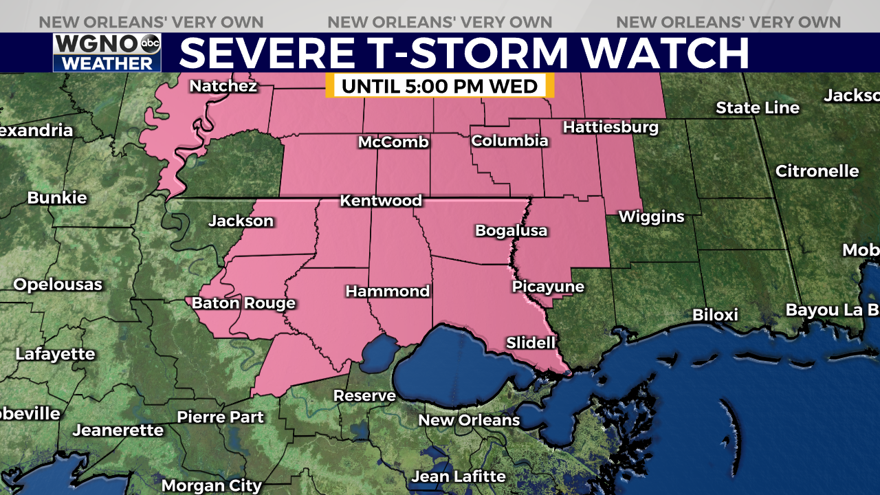
The main threat in any severe storms that form today will be damaging wind gusts, but a few isolated tornadoes cannot be ruled out.
We’re looking at two rounds of wet weather today. The first round began moving into the area earlier this morning and will through mid-afternoon Wednesday. Look for showers and storms to move through with the threat of gusty winds and locally heavy rain.
We’ll see a break from the rain as storm activity winds down Wednesday evening.
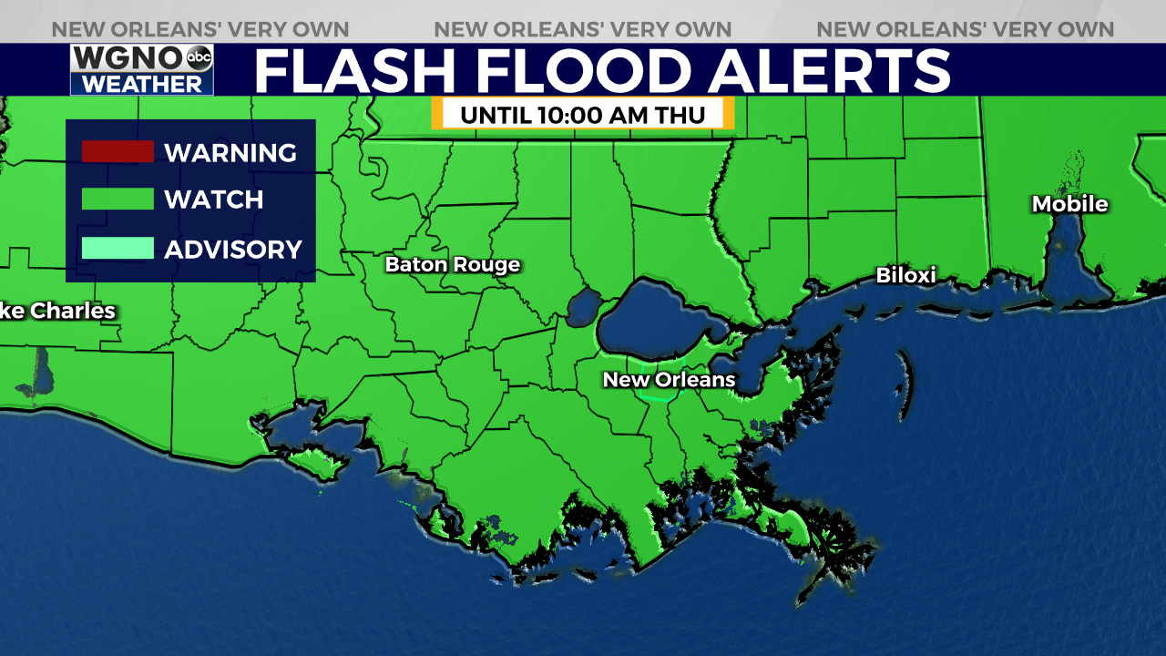
The second round of rain comes in late Wednesday night into Thursday morning. Flash flooding will be possible, especially in low-lying areas or locations with poor drainage. A Flash Flood Watch is in effect for the entire WGNO viewing area through Thursday morning.
After rain Thursday morning, the wet weather clears out just in time for the holiday weekend. We’ll be treated to some lower humidity on Friday and Saturday under mostly sunny skies with highs in the upper 80s.