NEW ORLEANS (WGNO) — Windy weather is expected across the region on Wednesday, especially for locations south of Lake Pontchartrain.
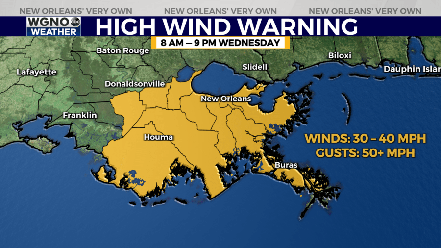
The National Weather Service has issued a rare “High Wind Warning” for most of Southeast Louisiana, beginning at 8 a.m. Wednesday. The warning lasts until at least 9 p.m.
In their warning, the NWS said “Damaging winds will blow down trees and power lines. Power outages are expected. Travel will be difficult, especially for high profile vehicles.”
The damaging wind gusts may extend well inland, stretching through Louisiana into Mississippi.

The high winds are expected before a line storms move into the New Orleans metro Wednesday evening. This squall line may bring severe thunderstorms with wind gusts in excess of 70 mph and tornadoes.
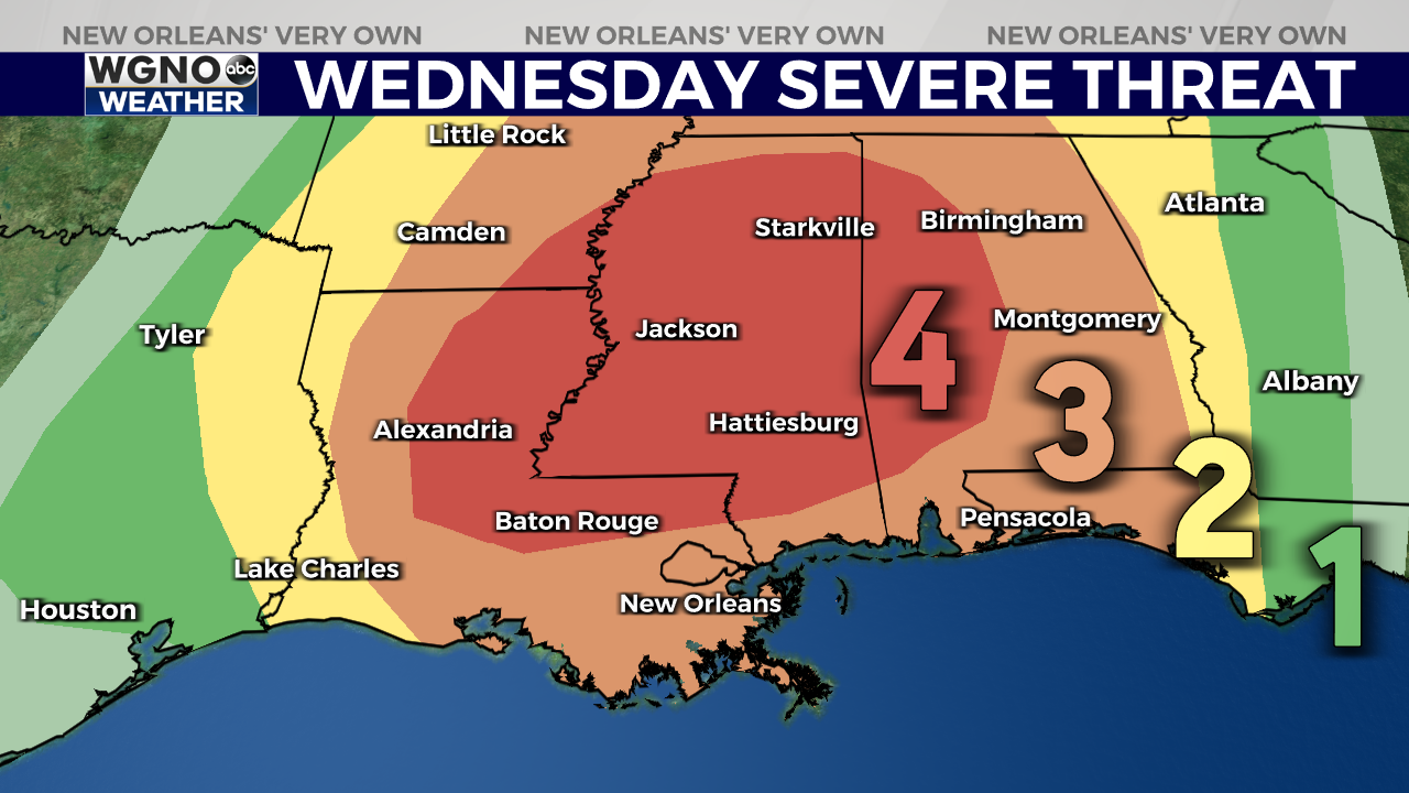
A large area near the Louisiana and Mississippi state line has been placed under a “Moderate Risk” for severe weather, which is threat level 4 out of 5 on the Storm Prediction Center’s scale.
This marks only the second time a “Moderate Risk” has ever been issued for our area during the month of March, with the first time having been last Tuesday.
Just to the south, most of the Mississippi Gulf Coast and New Orleans metro have been placed under an “Enhanced Risk” (threat level 3 out of 5). This extends all the way south to our Louisiana coastline.
The latest run of high-resolution weather models show that showers and a few storms will be possible starting at around 4 p.m. ahead of the main squall line.
It appears the bulk of the storms will move through between 5 p.m. and 10 p.m., with the heaviest storm activity right around sunset.