Happy Monday as yet another beautiful one returns across New Orleans and southeast Louisiana. Temperatures will reach the mid to upper 70s this afternoon.
We will stay dry today, but clouds build back in by the evening ahead of our next weather system. Expect winds to pick up out of the south and southeast, helping bring in warmer, more humid air throughout the day.
The next rain chance is tomorrow. We are continuing to monitor the development of our next storm system as models show it bringing heavy rain and severe storms to Louisiana and Mississippi.
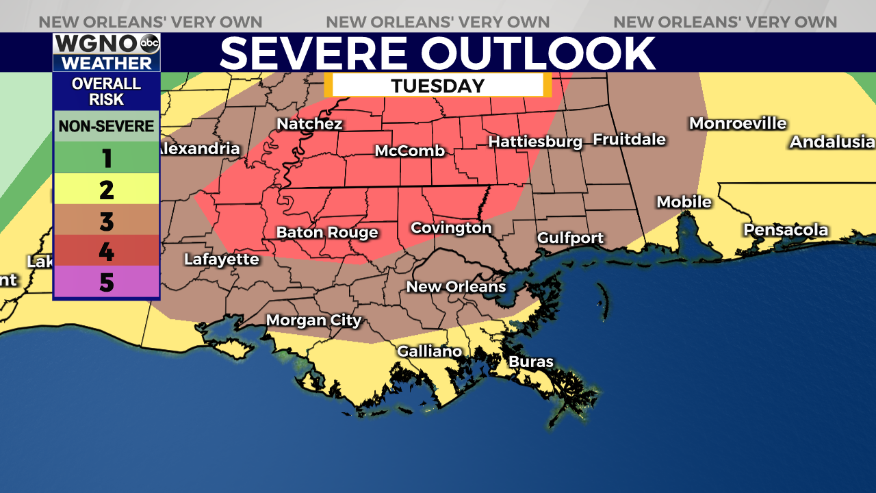
A large area near the Louisiana and Mississippi state line has been placed under a “Moderate Risk” for severe weather, which is threat level 4 out of 5 on the Storm Prediction Center’s scale. To the south, most of the Mississippi Gulf Coast and New Orleans metro have been placed under an “Enhanced Risk” (threat level 3 out of 5). Timing will be between 3PM and 11PM from west to east.
It appears the bulk of the storms will move through in the afternoon or evening. Areas included in the Enhanced Risk should expect 1-2 inches in rainfall, sustained winds between 15-25 miles per hour, and gusts up to 40 miles per hours with the possibility of some brief, weak, spin-up tornadoes. Areas included in the Moderate Risk should expect 2-4 inches in rainfall, sustained winds between 15-25 miles per hour, and gusts up to 40 miles per hours with the possibility of some long track tornadoes.
Have ways you can receive warning information on hand, and stay weather aware!


